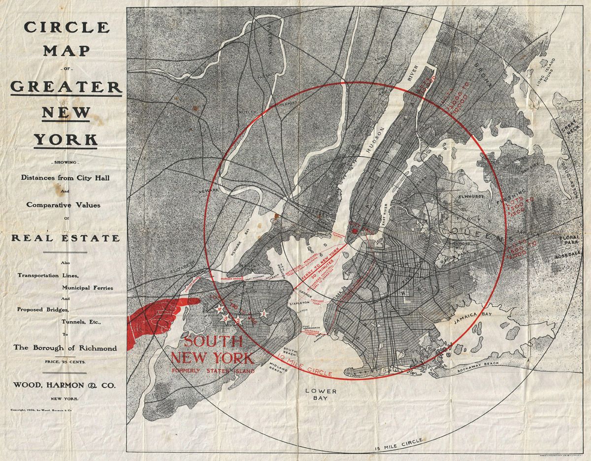
This is a vintage map titled "Circle Map of Greater New York". It's a black and white illustration with red highlights. The map depicts the five boroughs of New York City, with a prominent red circle encompassing a large portion of the city. **Key Features:** * **Boroughs:** The map clearly shows the outlines of Manhattan, Brooklyn, Queens, The Bronx, and Staten Island (labeled as "The Borough of Richmond"). * **Waterways:** The Hudson River, East River, and various bays (Jamaica Bay, Lower Bay, etc.) are depicted in detail. * **Transportation:** Lines indicate transportation routes, including municipal ferries and proposed bridges/tunnels. * **Circles:** Two concentric red circles are drawn on the map, labeled as the "10 Mile Circle" and the "15 Mile Circle". These circles likely represent distances from City Hall. * **Text:** The map includes various text labels identifying boroughs, waterways, and other features. There's also text detailing the map's purpose (showing distances from City Hall and comparative values of real estate). * **Beaches:** Several beaches are labeled along the coastline. * **Overall Style:** The map has a classic, vintage aesthetic with detailed linework and a slightly aged appearance. **Additional Details:** * The map is credited to "Wood, Harmon & Co., New York". * The copyright date is 1898. * The map is designed to show distances from City Hall and comparative values of real estate.