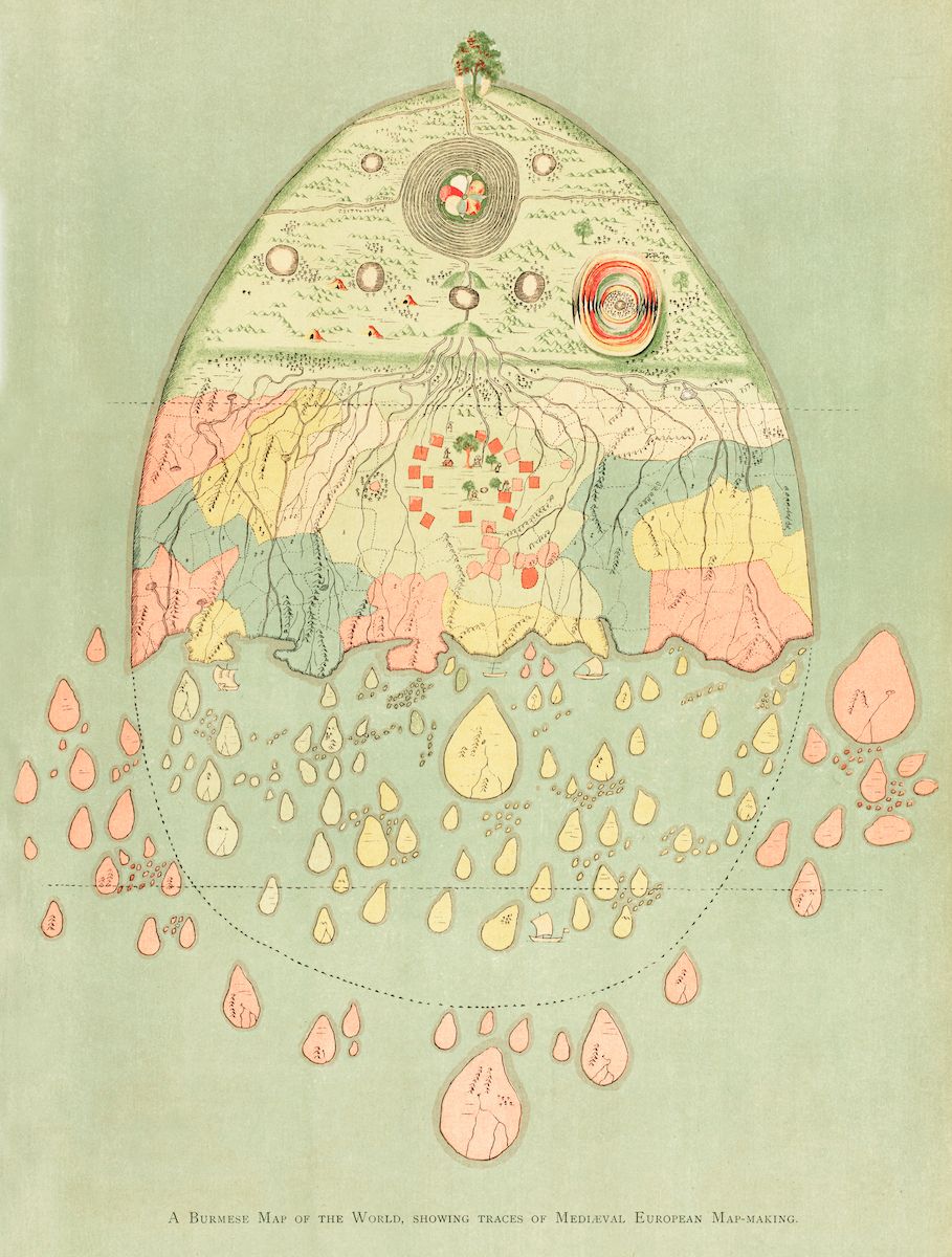
The image is a vintage, hand-colored map titled "A Burmese Map of the World, showing traces of Medieval European Map-Making." It's rendered in a circular format on a pale green background. The map itself is a complex arrangement of landmasses, bodies of water, and symbolic representations. The central area of the map features a stylized depiction of Mount Meru, a sacred mountain in Buddhist cosmology, surrounded by concentric circles and intricate patterns. From this central point, landmasses radiate outwards, resembling a network of islands and continents. These landmasses are colored in shades of pink, yellow, and green, and are outlined with delicate lines. Scattered throughout the map are numerous small, teardrop-shaped islands, each with a unique shape and color. These islands are arranged in a seemingly random pattern, creating a sense of vastness and exploration. The map also includes depictions of rivers, lakes, and other geographical features, rendered in a stylized and symbolic manner. The overall aesthetic of the map is reminiscent of medieval European cartography, with its emphasis on symbolism, stylized representations, and a lack of precise geographical accuracy. However, the map also incorporates elements of Burmese cosmology and artistic traditions, creating a unique and fascinating blend of cultural influences.