maptextcountycolornumberGeorgialand ownershipAfrican Americans1870-1900maphistoricaldataacreagecounties
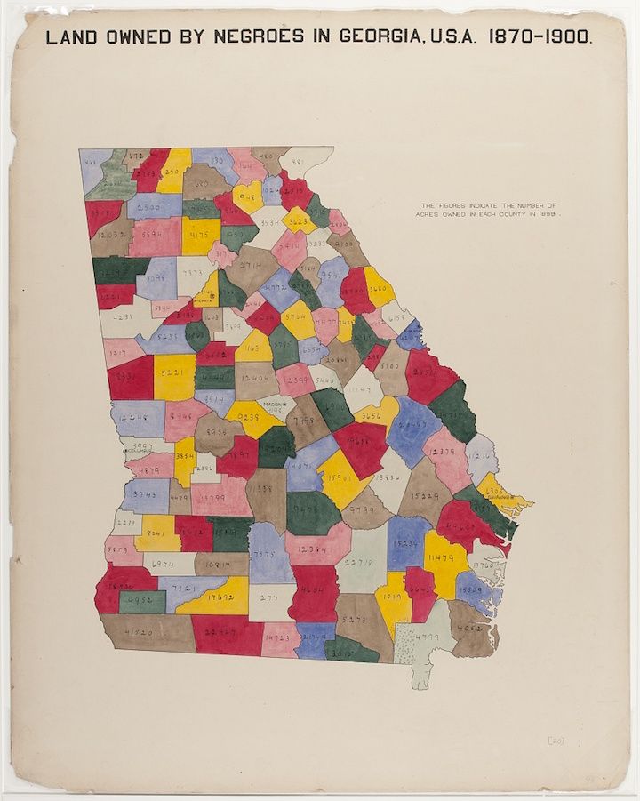
The image is a vintage map titled "Land Owned by Negroes in Georgia, U.S.A. 1870-1900". It depicts the state of Georgia divided into counties, each filled with a different color. Within each county, a number is written, presumably indicating the number of acres owned by African Americans in that county during the specified period. The colors used are varied, including shades of pink, blue, yellow, green, and red. The map appears to be hand-colored or painted, giving it a slightly aged and textured look. The background is a cream-colored paper, and there are some signs of wear and tear around the edges. A note on the right side of the map states that the figures indicate the number of acres owned in each county in 1898.
License: CC0