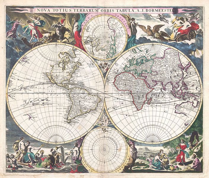
This is a detailed, antique-style world map from 1683, titled 'Nova Totius Terrarum Orbis Tabula, A.J. Borrmeester'. It's presented in a decorative, ornate style typical of maps from that era. The map is divided into three main circular projections of the world, arranged in a cloverleaf pattern. Each circle represents a different portion of the globe. The continents are depicted with detailed coastlines and interior features, though the accuracy is limited by the knowledge of the time. The Americas are visible, as are Europe, Africa, and Asia. Australia is partially depicted, but its shape is not fully accurate. Around the central map projections are allegorical scenes and decorative elements. At the top, there's a depiction of the sun with figures surrounding it. At the bottom, there are scenes of people engaged in various activities, including farming, hunting, and sailing. The corners of the map feature depictions of the four seasons, each represented by figures and symbols. The map is richly colored, with blues for the oceans, greens and browns for the land, and reds for political boundaries. The overall style is highly decorative, with intricate patterns and embellishments. The map is framed by a border with ornate designs and inscriptions. The map is a beautiful example of cartography from the 17th century, showcasing both the geographical knowledge and artistic sensibilities of the time.