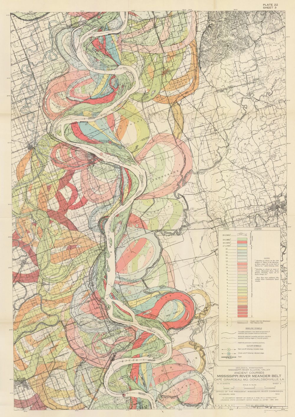
The image is a detailed geological map of the Mississippi River Meander Belt, specifically focusing on the area between Cape Girardeau, Missouri, and Donaldsonville, Louisiana. The map is rendered in a vintage style, likely from the mid-20th century, with a color-coded scheme to represent different geological features. The dominant feature is the Mississippi River, which snakes its way through the landscape in a series of pronounced meanders. The river is depicted in shades of blue, and its course is highly sinuous, creating numerous oxbow lakes and abandoned channels. The surrounding land is color-coded to indicate various geological formations and landforms. Key features include: * **Floodplain:** Large areas are colored in shades of green and yellow, representing the active floodplain of the river. * **Alluvial Terraces:** Stepped terraces of varying heights are shown in shades of brown and orange, indicating former floodplains and river levels. * **Natural Levees:** Ridges along the riverbanks are highlighted in darker shades, representing natural levees formed by sediment deposition. * **Backswamps:** Low-lying areas behind the levees are colored in shades of blue and green, representing backswamps and poorly drained areas. * **Yazoo Basins:** Depressions along the riverbanks are shown in blue, representing Yazoo basins, which are areas where tributaries flow parallel to the river. * **Bluffs:** Elevated areas along the river are depicted in brown and orange, representing bluffs and higher ground. The map also includes contour lines, which indicate the elevation of the land. There is a legend in the lower right corner that explains the color-coding and symbols used on the map. Additionally, there is a scale and a north arrow to provide orientation and distance measurements. The map is titled "Mississippi River Meander Belt" and includes the names of the cities mentioned above. The map is a valuable resource for understanding the geological history and landforms of the Mississippi River Valley.