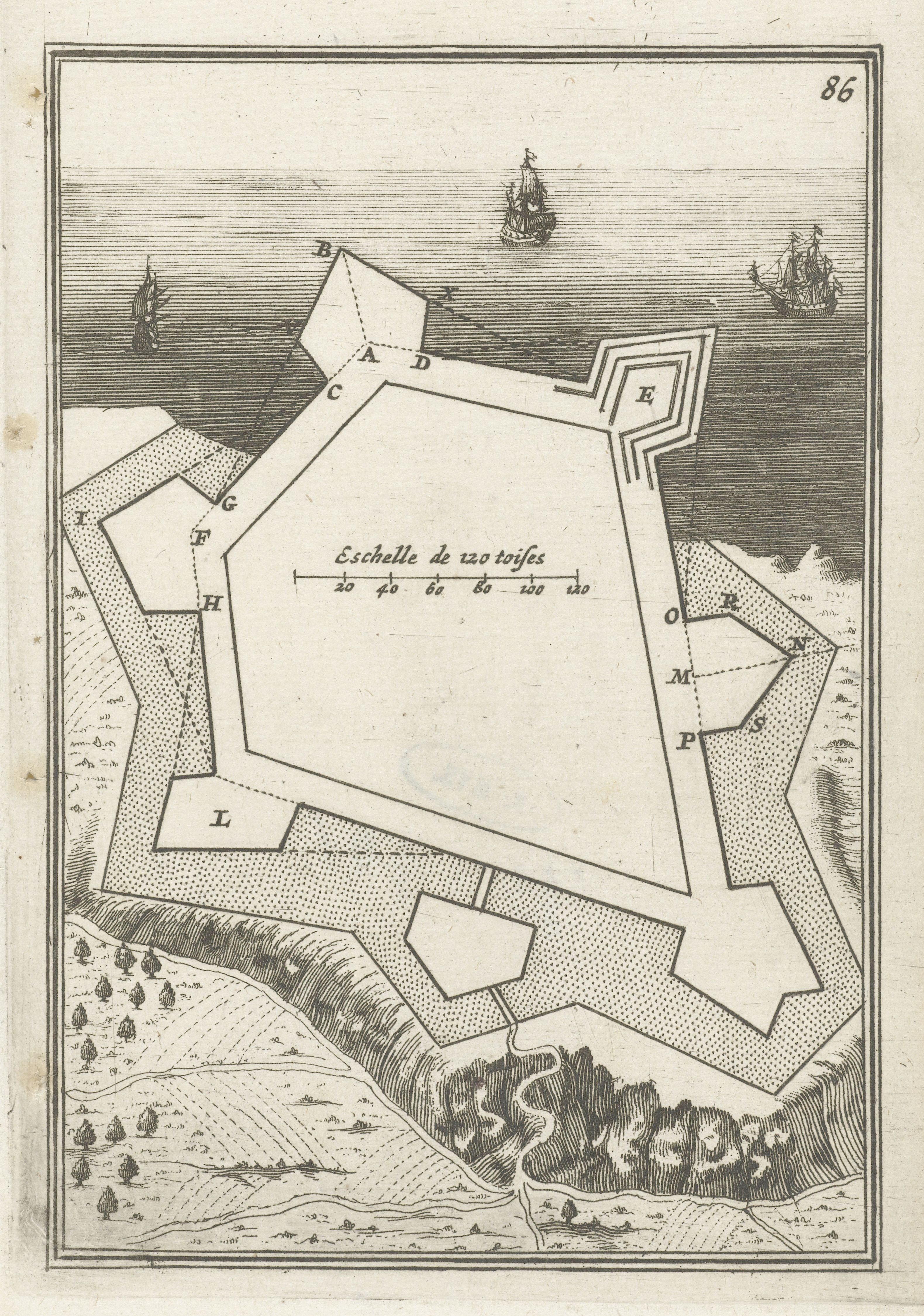
This is a vintage map or plan of a fort, likely from the 17th or 18th century, rendered in a detailed, engraved style. The fort is a complex, star-shaped structure with multiple bastions labeled with letters (A, B, C, D, E, F, G, H, I, K, L, M, N, O, P, S). The fort is surrounded by a moat and a landscape of trees and vegetation. Several ships are depicted sailing on the water surrounding the fort, suggesting a coastal location. A scale is present, labeled 'Échelle de 120 toises' with measurements in units of 20, 40, 60, 80, 100, and 120. The map is aged, with a slightly yellowed paper tone and visible lines from the engraving process. The overall style is reminiscent of historical cartography, with a focus on precise detail and geometric representation.