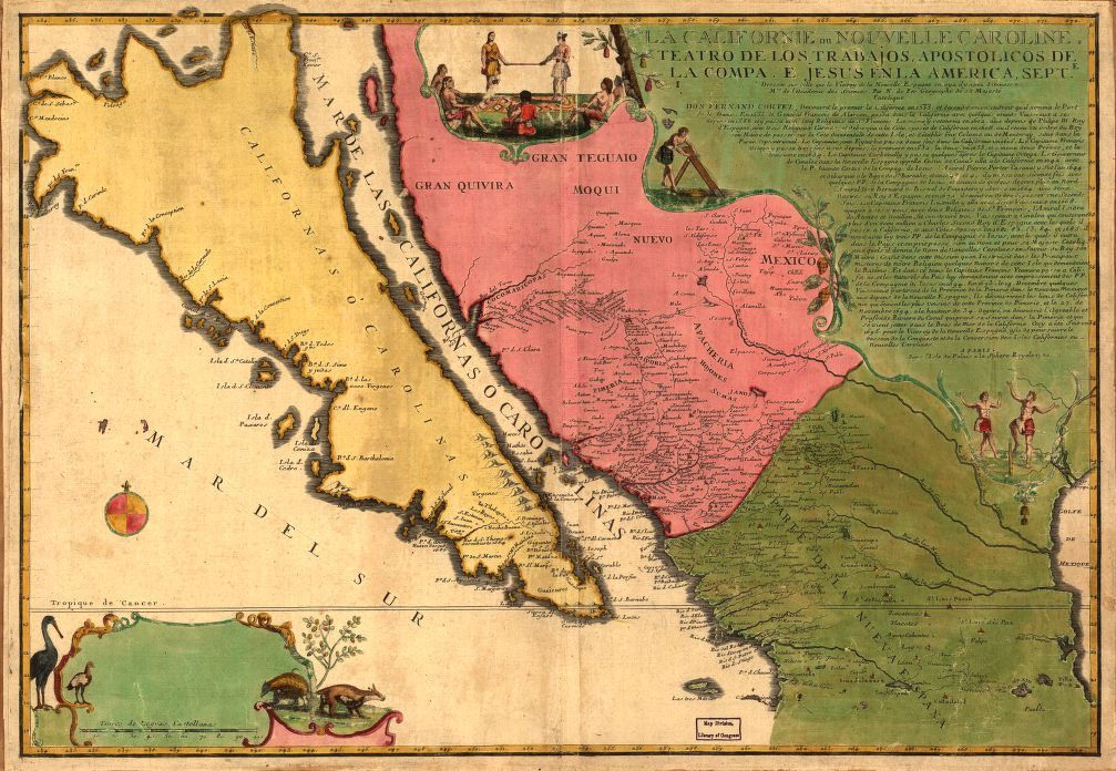
This is a vintage map of the Baja California peninsula and parts of western Mexico, dating back to September 1742. The map is titled "La Californie Nouvelle Carolie: Teatro de los Trabajos Apostolicos de la Compa. de Jesus en la America." It's a detailed cartographic representation with a distinctive aesthetic. The Baja California peninsula is prominently featured, depicted as a long, narrow landmass. The map incorrectly shows Baja California as an island, a common misconception in early cartography. The coastline is intricately drawn, with numerous bays, inlets, and islands. The interior of the peninsula is marked with mountains and rivers. To the east of Baja California is the mainland of Mexico, with areas labeled like "Nuevo Mexico" and "Mexico." The map shows a portion of the Pacific coastline of Mexico, with cities and settlements indicated. The map is adorned with various illustrations and decorative elements. There's a cartouche in the upper right corner with text describing the map's purpose and authorship. In the lower left corner, there's an illustration of a bird and a sea monster. A compass rose is present, indicating the cardinal directions. A scale bar is also included to indicate distances. The map is colored in shades of beige, pink, and blue, with intricate line work and calligraphy. The overall aesthetic is reminiscent of 18th-century cartography, with a blend of scientific accuracy and artistic embellishment.