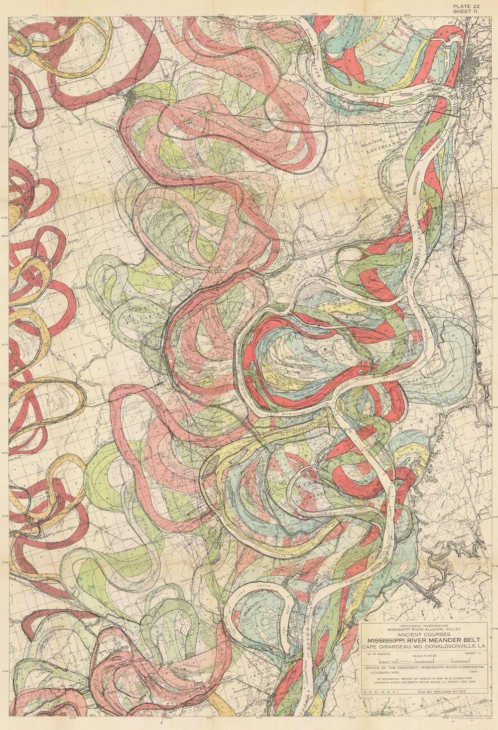
The image is a vintage, detailed map titled "Ancient River Courses, Mississippi River Meander Belt, Cape Girardeau, Mo. to Donaldsonville, La.". It's a topographical map with a color scheme dominated by yellows, greens, reds, and blues. The map depicts the Mississippi River and its historical meander belt, showing the river's changing courses over time. The current river course is highlighted in a bold red line, winding its way down the map. Surrounding this are numerous loops and curves in pink, yellow, and green, representing the ancient, abandoned river channels. These ancient courses create a complex, almost labyrinthine pattern across the landscape. The terrain is indicated by contour lines and shading, showing the elevation changes and floodplains. There's a legend in the bottom right corner with detailed explanations of the colors and symbols used on the map. The map also includes text labels indicating towns, counties, and other geographical features. The overall impression is of a meticulously researched and visually striking representation of the Mississippi River's dynamic history and the ever-changing landscape it has shaped.