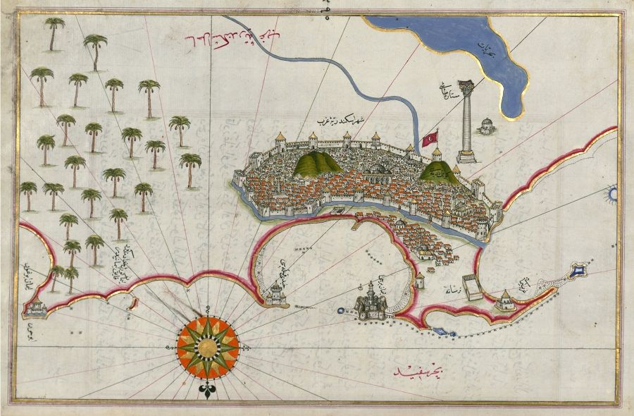
This is a detailed, antique map or illustration of a coastal city, likely from a historical Ottoman or Middle Eastern context. The style is reminiscent of portolan charts or city views from that era. The city is the focal point, densely packed with small, red-roofed buildings, suggesting a bustling urban center. It's surrounded by a substantial defensive wall with multiple towers and fortifications. A prominent flag flies atop a central structure within the city, likely a palace or important administrative building. The city is built on a hilly terrain, adding to its visual complexity. To the left of the city, a dense grove of palm trees lines the coast, providing a lush contrast to the built environment. The coastline itself is irregular, with a curved bay and rocky outcrops. The water is depicted with small wave-like patterns. At the bottom center of the image, a decorative compass rose is visible, indicating the cardinal directions. Various labels and text in an Arabic or Ottoman script are scattered throughout the map, identifying landmarks, neighborhoods, or geographical features. The overall color palette is muted, with earthy tones of beige, brown, and red dominating the scene. The illustration is highly detailed, with intricate depictions of buildings, fortifications, and natural features. The style suggests a hand-drawn or painted artwork, possibly created for navigational or administrative purposes.