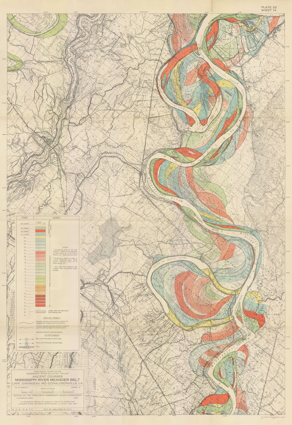
This is a vintage, detailed map depicting the ancient courses of the Mississippi River between Vicksburg and Greenville, Mississippi. The map is a complex illustration of the river's meanders and changes over time, using a variety of colors to represent different stages and types of river features. The dominant feature is the winding Mississippi River itself, shown in shades of blue. Surrounding the river are areas of land, depicted in muted greens, yellows, and browns, representing different soil types and elevations. The map is overlaid with a network of colored lines and patterns that illustrate the ancient courses of the river. These lines are coded with a legend that identifies different stages of river development, such as abandoned channels, natural levees, and meander scars. The map is labeled with place names, geographic features, and technical information. A detailed legend in the lower-left corner explains the color-coding and symbols used on the map. The map is titled "Ancient Courses of the Mississippi River" and includes information about the source of the data and the organization responsible for creating the map. The overall impression is one of meticulous detail and scientific accuracy, reflecting the effort to document and understand the complex history of the Mississippi River.