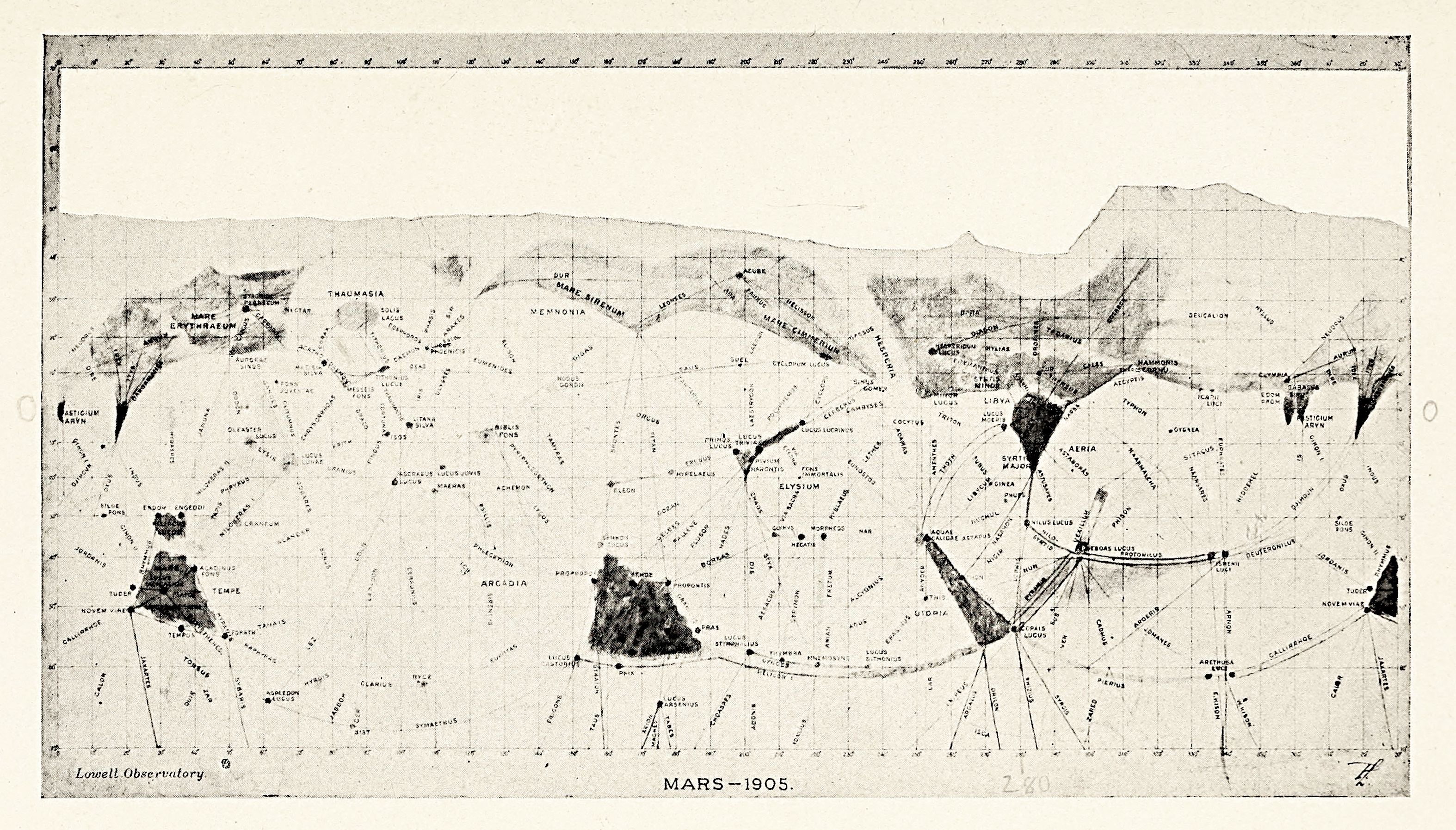
This is a vintage map of Mars, dated 1905, created by the Lowell Observatory. It's a black and white illustration with a highly detailed, almost chaotic, network of lines representing what were believed to be surface features, including canals. The map is a projection of the Martian surface, showing a large portion of the planet. Dark, irregularly shaped areas represent major features like Syrtis Major, Arcadia, and Hellas. These are contrasted by lighter areas that make up the majority of the surface. A dense web of thin, straight lines crisscrosses the map, connecting these dark areas and forming what were thought to be canals. These lines are often clustered around the dark regions and extend across the lighter areas. Numerous labels and symbols are scattered across the map, identifying specific features and regions. A grid of latitude and longitude lines is present along the top edge, providing a coordinate system. The overall impression is one of a meticulously detailed, yet somewhat speculative, representation of the Martian surface as understood in the early 20th century. The style is reminiscent of scientific illustrations from that era, with a focus on precise linework and detailed labeling.