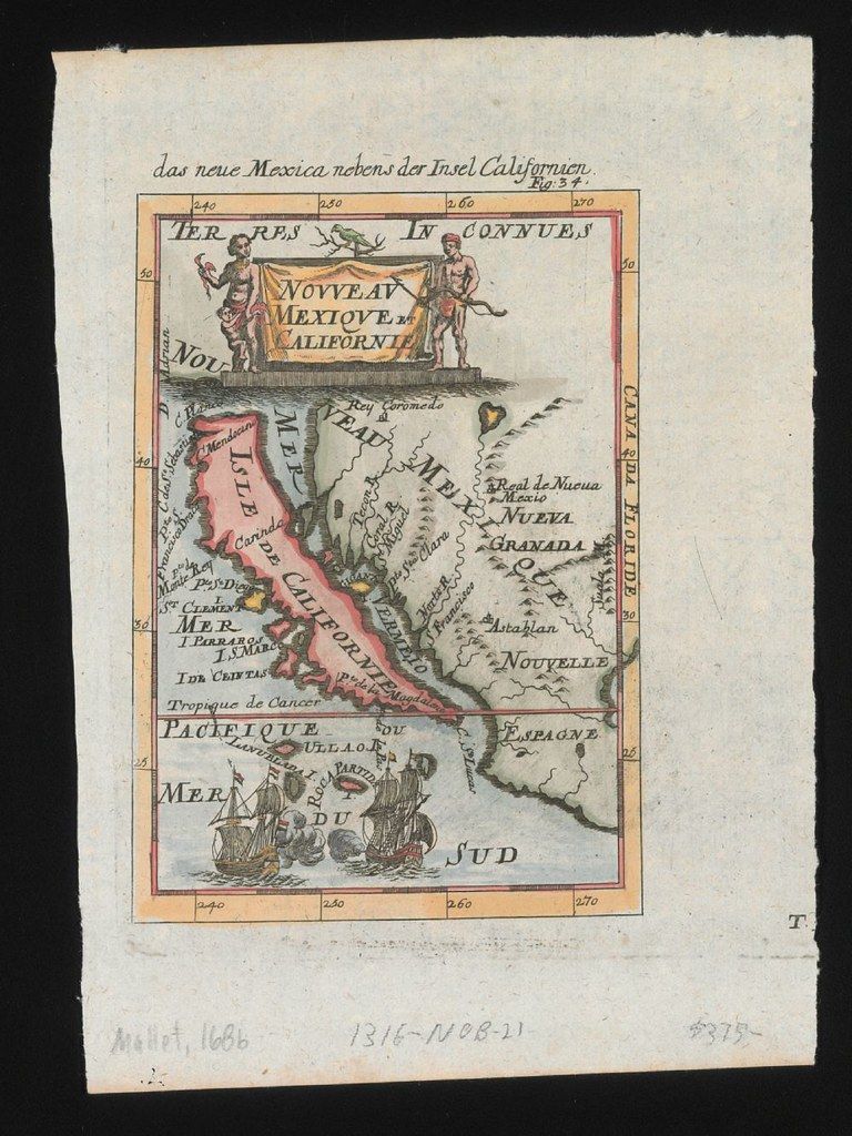
This is a vintage map titled "das neue Mexico neben der Insel Californien" (New Mexico next to the Island of California). It's a hand-colored map with a pink and green color scheme. The map depicts a distorted representation of the Baja California peninsula, which is shown as a large island. The landmass is labeled "NOUVELLE CALIFORNIE" and "NOUVE MEXICO". To the west of California is the "MER PACIFIQUE" (Pacific Ocean). To the east is a landmass labeled "TERRES INCONNUES" (Unknown Lands). A ship is illustrated in the lower left corner, sailing on the ocean. The map includes various place names and geographical features, written in a mix of languages. There are also lines indicating latitude and longitude. The map is framed by a decorative border with numbers along the edges. There are handwritten numbers and markings in the margins, likely cataloging or inventory information. The overall style is characteristic of early cartography, with a focus on exploration and a somewhat inaccurate depiction of geography.