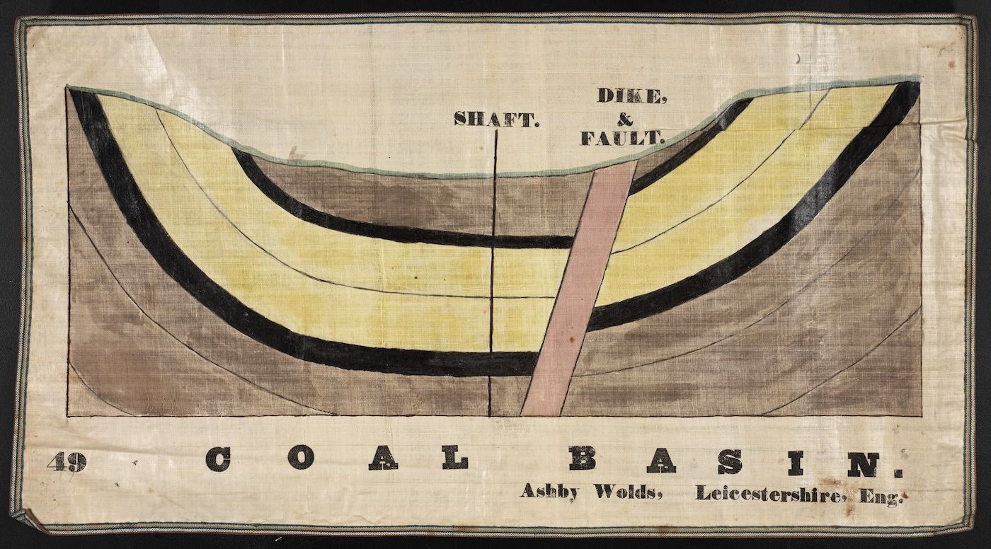
The image is a vintage diagram of a coal basin, likely from a geological or mining publication. It's rendered in a style reminiscent of 19th-century scientific illustrations, with a limited color palette of brown, blue, and white on a cream-colored background. The diagram depicts a cross-section of the earth, showing layers of rock and coal. A dark, curved band represents the coal seam, and above it are layers of lighter-colored rock. A vertical line labeled 'SHAFT' indicates a mine shaft extending down to the coal seam. A jagged line labeled 'DIKE & FAULT' cuts through the layers, representing a geological fault. Below the diagram, in bold, block letters, is the text 'COAL BASIN'. Beneath that, in smaller text, is the location: 'Ashby Wolds, Leicestershire, Eng.'. In the top left corner, the number '49' is printed. The entire image is framed by a simple border. The style of the illustration suggests it's a historical document, possibly a plate from a book or journal.