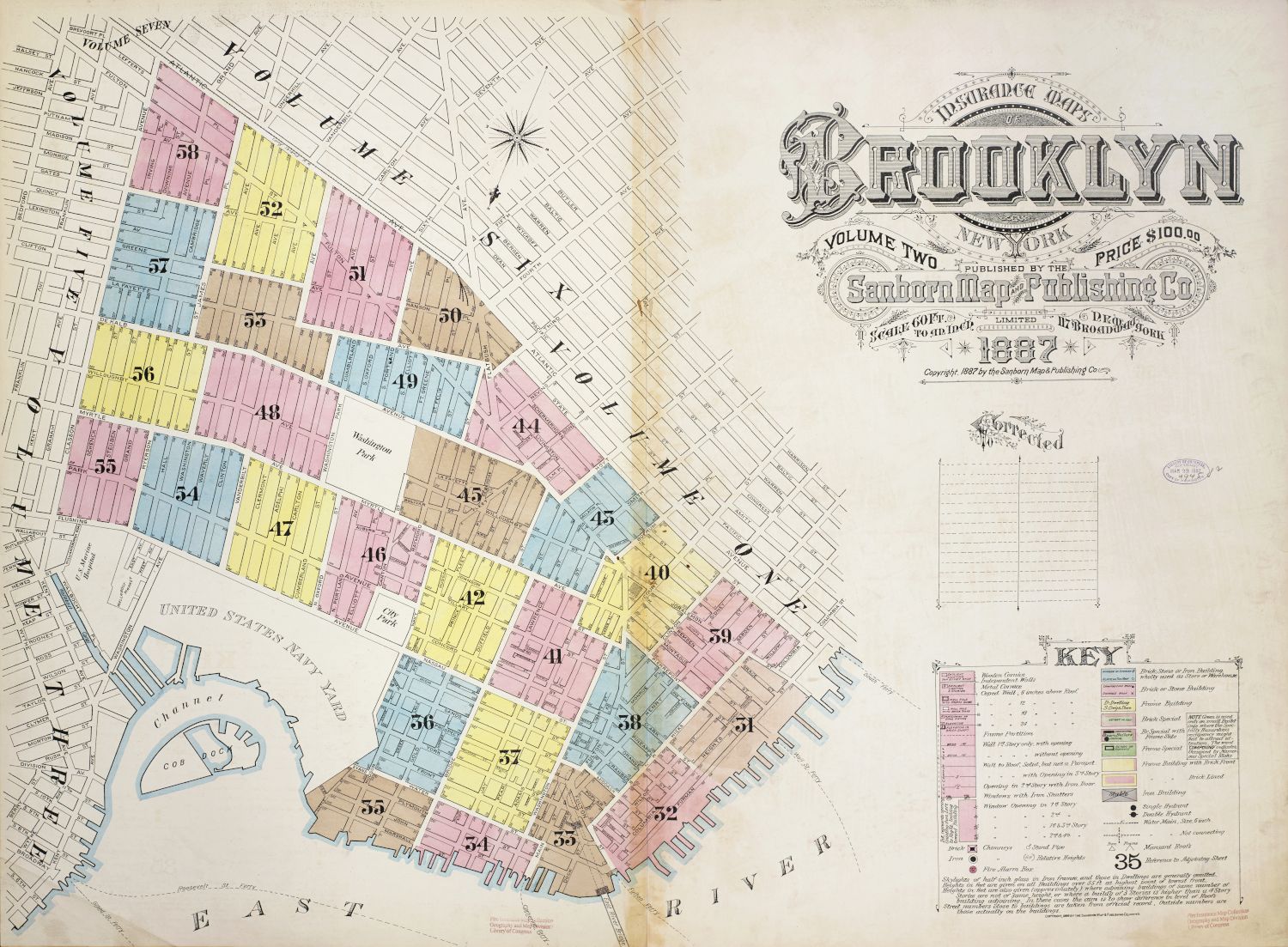
The image is a vintage map of Brooklyn, New York, dated 1887. It's a detailed street map with a grid-like structure, divided into numbered sections. The map is rendered in a variety of pastel colors, each likely representing different types of land use or neighborhoods. **Key Features:** * **Map Area:** The majority of the image is occupied by the map itself, showing streets, buildings, parks, and waterways. The map is divided into numbered sections (e.g., 41, 42, 43, etc.) with clear street names. * **Waterways:** The map shows the coastline and waterways surrounding Brooklyn, including the East River and what appears to be the entrance to New York Harbor. There's a depiction of the United States Navy Yard. * **Parks:** Several green areas indicate parks and open spaces within the city. * **Railroads:** Black lines represent railroad tracks running through various parts of Brooklyn. * **Title and Publisher Information:** In the upper right corner, there's a decorative title that reads “Brooklyn” in ornate lettering. Below this, it states “Volume Two” and the publisher’s name, “Sanborn Map Publishing Co.” The price of the map is listed as $100.00. * **Date and Copyright:** The date “1887” is prominently displayed, along with a copyright notice. * **Key/Legend:** In the lower right corner, there's a “Key” or legend that explains the symbols and colors used on the map. It lists various building types (e.g., brick, frame, stone) and their corresponding representations. * **Compass Rose:** A compass rose is visible, indicating the cardinal directions. **Overall Impression:** The map is a historical document that provides a detailed snapshot of Brooklyn in the late 19th century. The use of color and symbols makes it visually engaging, while the detailed street layout and building information offer valuable insights into the city's urban landscape at that time. The map is aged and shows signs of wear, adding to its vintage charm. **Color Palette:** The map uses a range of pastel colors, including shades of pink, purple, blue, green, and yellow, to differentiate between different areas and land uses. The streets and building outlines are typically rendered in black or dark gray.