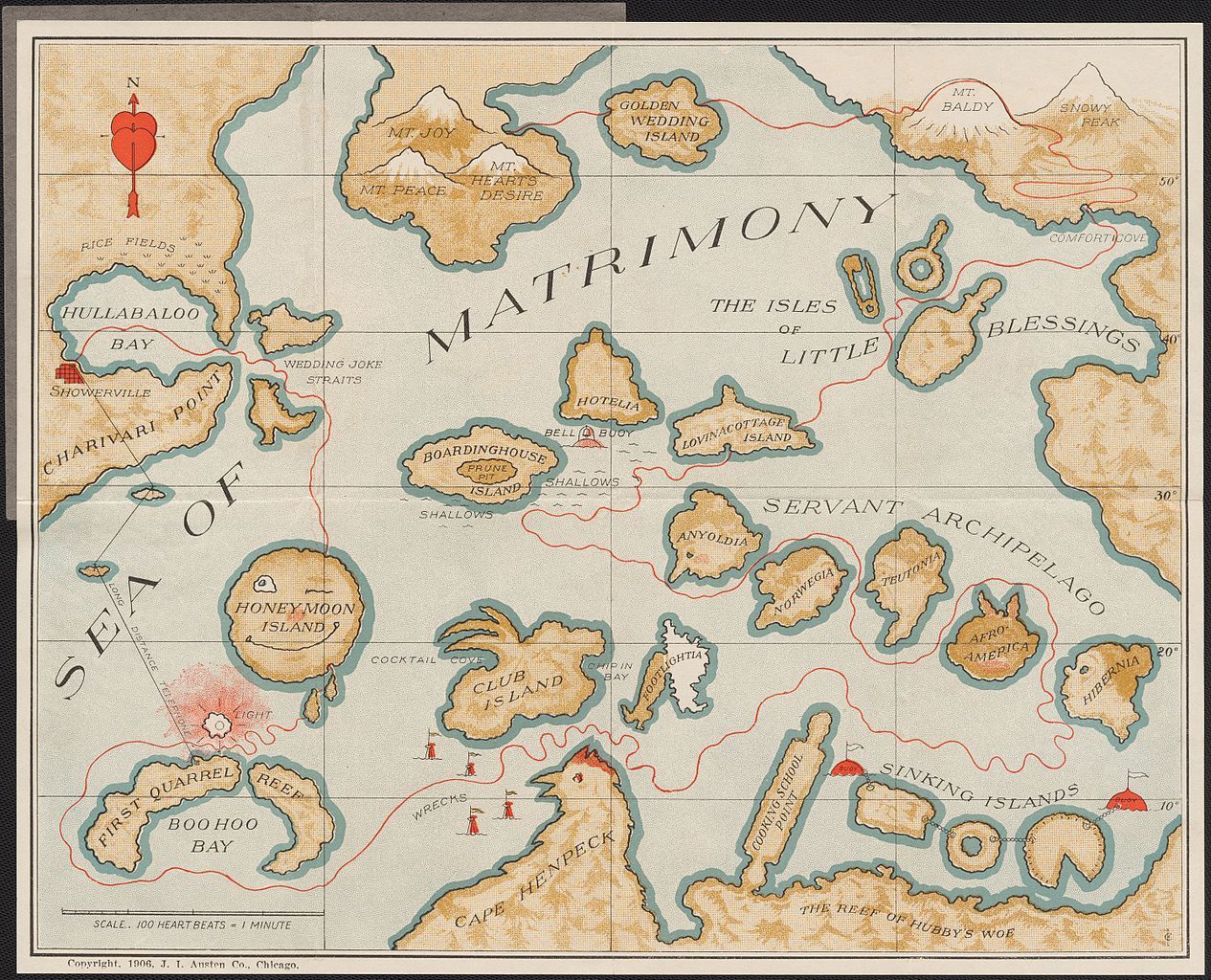
This is a vintage, illustrated map titled 'The Sea of Matrimony'. It's designed as a whimsical, metaphorical map of marriage, with various locations representing aspects of married life. The map is rendered in a faded, sepia-toned style, giving it an antique appearance. The 'Sea of Matrimony' is a large body of water dominating the center of the map. Scattered throughout the sea are numerous islands, each with a humorous name. Some notable islands include 'Honeymoon Island', 'Cocktail Club Island', 'Golden Wedding Island', and 'Servant Archipelago'. Several bays and points of land are labeled with equally playful names, such as 'Hullabaloo Bay', 'Showerville', 'Boohoo Bay', and 'Cape Henpeck'. 'First Quarrel Reef' is depicted as a dangerous area near 'Boohoo Bay'. The map also features various hazards and landmarks, like 'Shallows', 'Wrecks', and 'The Reef of Hubby's Woes'. A compass rose is positioned in the upper left corner, and a scale at the bottom reads 'Scale: 100 Heartbeats = 1 Minute'. The overall style is cartoonish and illustrative, with detailed depictions of the islands and surrounding waters. The map is a clever and humorous take on the complexities of marriage, presented in a visually engaging and nostalgic format.