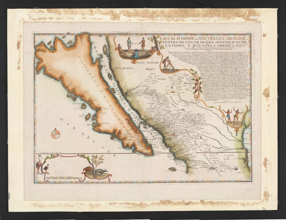
This is a vintage map titled "LA CALIFORNIE & NOUVELLE CAROLINE. TEATRO DE LOS TRABAJOS APOSTOLICOS DE LA COMPAÑIA DE JESUS EN LA AMERICA SEPT.". It depicts a geographical representation of California and parts of the southwestern United States and Mexico. The map is rendered in a style typical of the 17th or 18th century, with detailed coastlines and inland features. California is depicted as a large island, a common misconception in early maps. The landmass is colored in shades of green and brown, indicating terrain. The ocean is a light blue, with waves and sea creatures illustrated. Several place names are labeled in Spanish, including "Gran Rio de Quivira" and "Nuevo Mexico". A compass rose is present, indicating directions. There are also illustrations of ships and small figures engaged in various activities, likely representing the work of the Jesuit missionaries mentioned in the title. The map is framed by a decorative border with floral motifs and heraldic symbols. The overall condition of the map appears to be good, with some signs of age and wear. The paper has a slightly yellowed tone, and there are some minor creases and stains.