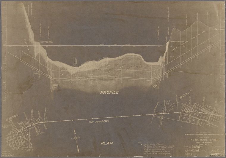
This is a sepia-toned technical drawing or map, likely from the early 20th century, depicting a plan and profile for a tunnel under “The Narrows,” the waterway between Staten Island and Brooklyn. The map is dominated by a large, curved depiction of the waterway, with Staten Island on the left and Brooklyn on the right. A horizontal line represents the proposed tunnel route, extending from one shore to the other. Above the waterway is a “PROFILE” section, showing a cross-sectional view of the land elevation and the tunnel’s proposed depth. Below the waterway is a “PLAN” section, which appears to be a top-down view of the tunnel route and surrounding areas. Numerous lines and symbols are used to indicate elevations, distances, and other technical details. Text labels identify key locations, such as “Staten Island,” “Brooklyn,” and “The Narrows.” There are also grid lines and numerical annotations throughout the drawing. The overall impression is one of meticulous planning and engineering, typical of a large-scale infrastructure project. The sepia tone and aged paper suggest that this is a historical document.