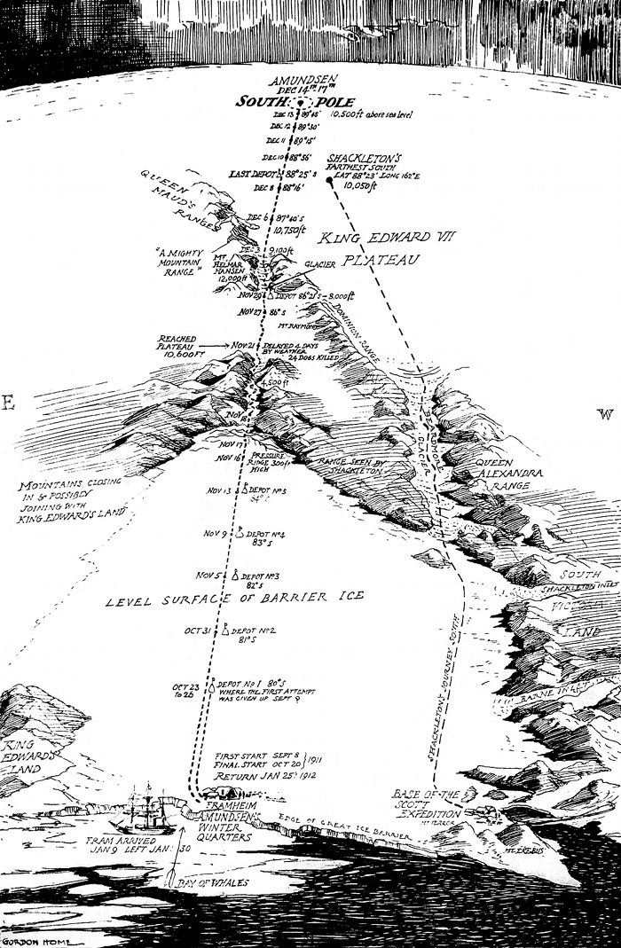
This is a detailed, vintage-style map or diagram depicting a polar landscape, likely Antarctica. It's rendered in a black and white, illustrative style, resembling a hand-drawn map from the early 20th century. The map is dominated by a vast expanse of ice, represented by textured shading and contour lines to indicate elevation. A large, elevated plateau is labeled “King Edward VII Glacier Plateau” and is the central feature. Mountains are depicted along the edges of the ice, with ranges labeled “Queen Alexandra Range” and “Transantarctic Mountains.” Numerous points are marked with “Depot” labels (e.g., “Depot No. 1,” “Depot No. 2,” etc.) and dates (e.g., “Oct 31,” “Nov 5”). These appear to be supply caches established during an expedition. Lines and arrows indicate the route taken by explorers, with notations of dates and altitudes. At the top of the map, “Amundsen South Pole” is prominently labeled, along with coordinates and altitude. “Shackleton’s Farthest South” is also marked. The lower portion of the map shows a “Level Surface of Barrier Ice” with a depiction of a “Base” and a scale. There's also a section labeled “Bay of Whales.” A compass rose is present, indicating the cardinal directions (N, S, E, W). The map is signed “Gordon Home” in the lower left corner. The overall impression is of a meticulously documented expedition map, likely created to record the progress and findings of an early Antarctic exploration.