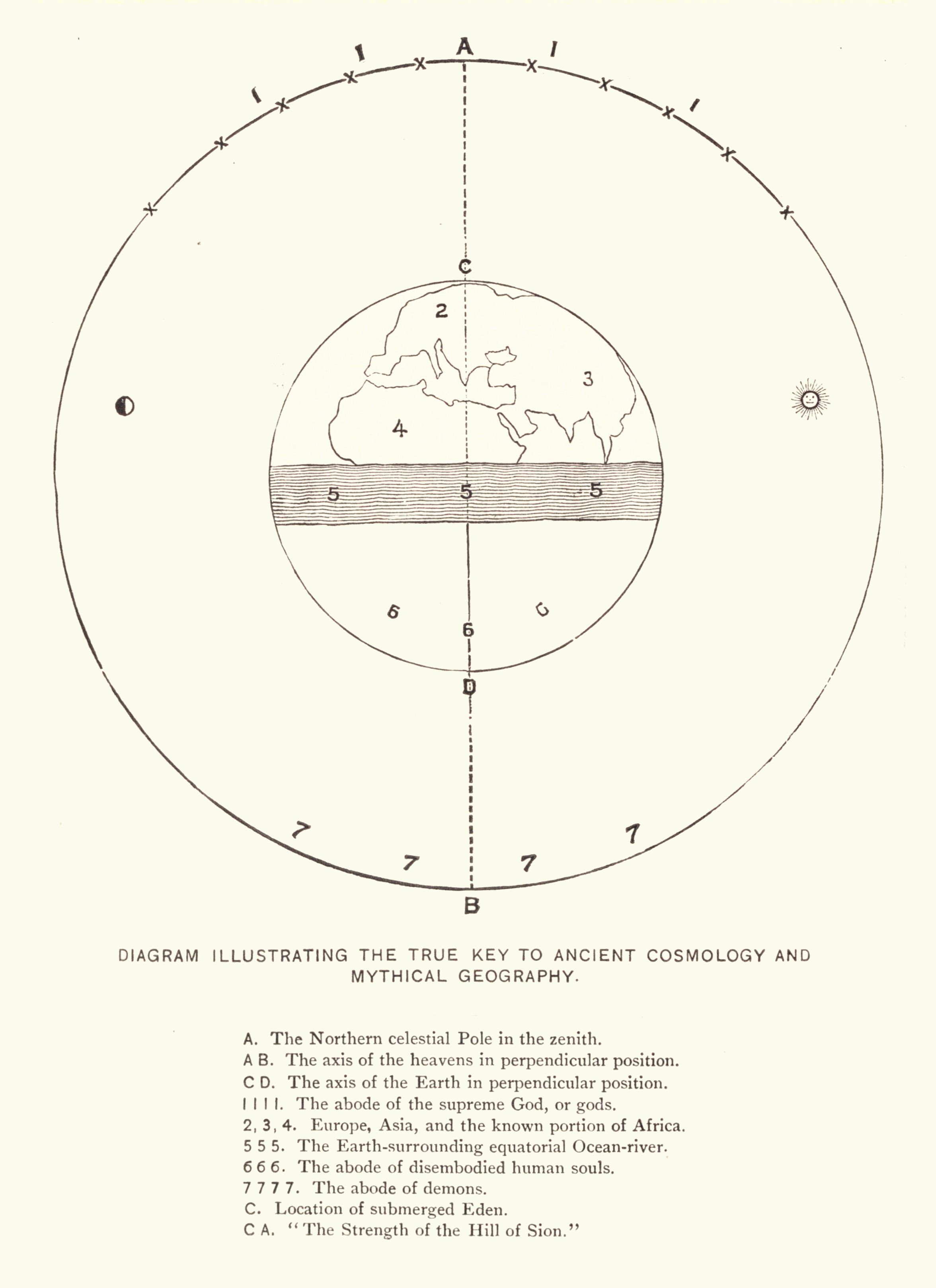
The image is a vintage diagram illustrating ancient cosmology and mythical geography. It's a circular design with several concentric circles and lines. **Central Features:** * A central point is marked with 'D', representing the axis of the Earth in a perpendicular position. * A vertical line runs through the center, labeled 'A B', indicating the axis of the heavens in a perpendicular position. * A shaded circular area represents the Earth, with landmasses depicted within it. The landmasses are labeled with numbers 2, 3, and 4, representing Europe, Asia, and Africa. * A wavy line surrounds the Earth, labeled '5 5', representing the equatorial ocean-river. * A larger circle encompasses the Earth and ocean, with numbers 1, 6, and 7 marking different zones. * A small circle is marked with 'C', indicating the location of submerged Eden. **Additional Details:** * The outermost circle is adorned with small 'x' marks. * Numbers 1, 2, 3, 4, 5, 6, and 7 are used as labels for different areas within the diagram. * Text labels are present throughout the diagram, explaining the significance of each element. * The diagram is titled "DIAGRAM ILLUSTRATING THE TRUE KEY TO ANCIENT COSMOLOGY AND MYTHICAL GEOGRAPHY." * Below the diagram is a key explaining the meaning of the numbers and letters used in the illustration. For example, 'A' represents the Northern celestial Pole in the zenith, '1 1 1 1' represents the abode of the supreme God, or gods, and '7 7 7 7' represents the abode of demons. The overall style of the diagram is reminiscent of historical scientific or mythological illustrations, with a focus on symbolic representation and detailed labeling.