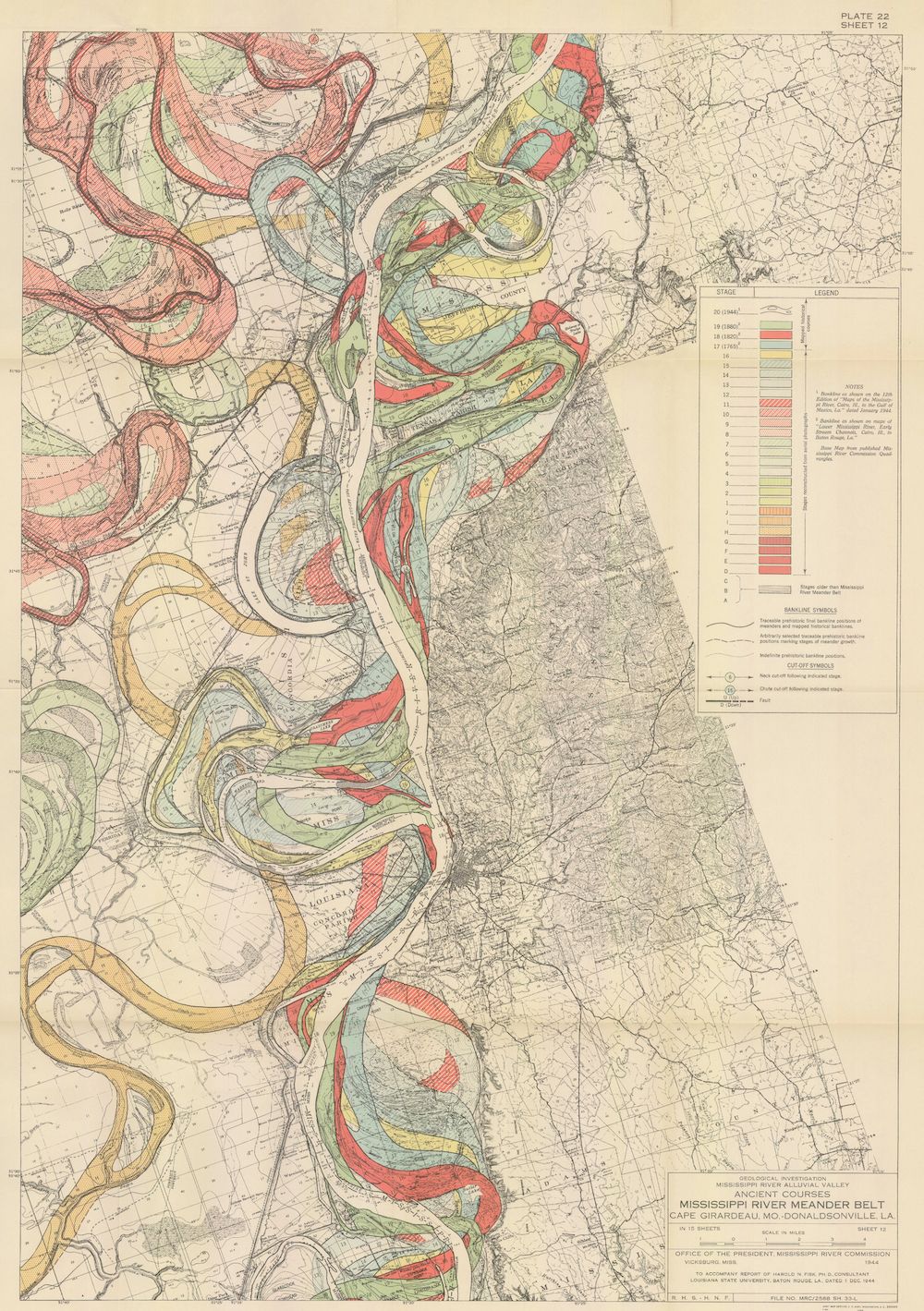
The image is a detailed, vintage map titled "Mississippi River Meander Belt, Cape Girardeau, Mo. to Donaldsonville, La.". It's a topographic map focusing on the Mississippi River and its surrounding floodplain. The river itself is a prominent feature, winding and curving in a series of meanders. The floodplain is color-coded to indicate different elevations and stages of flooding, with a legend on the right side of the map explaining the color scheme. The colors range from dark brown to light yellow, representing higher to lower elevations and flood stages. The map is filled with intricate details, including contour lines, symbols indicating various features, and a grid system for precise location. There's a scale at the bottom of the map for measuring distances. The map is aged, with a slightly yellowed and worn appearance, giving it a historical feel. The text is in a classic font, and the overall design is typical of topographic maps from the mid-20th century. The map is a valuable resource for understanding the geography and topography of the Mississippi River region, as well as its history of flooding and meander patterns.