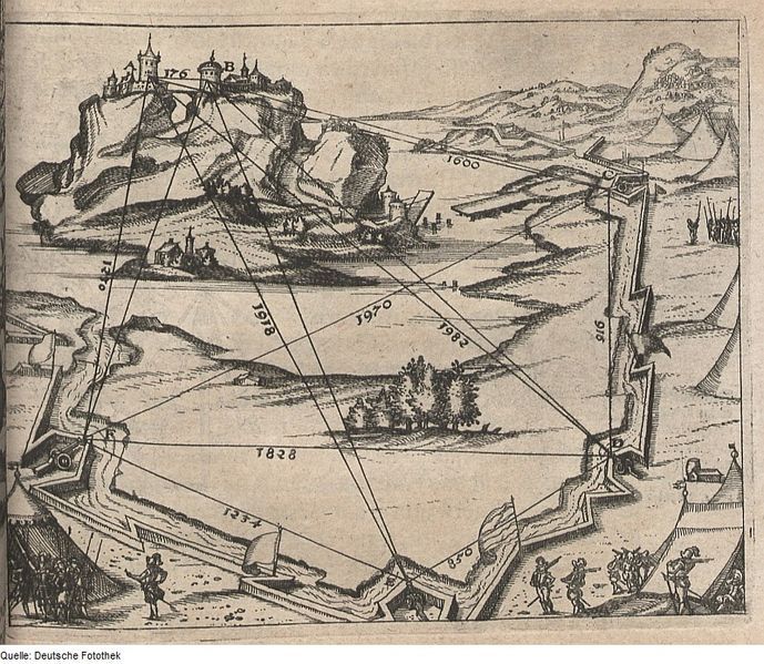
This is a detailed historical engraving depicting a fortified landscape. A large castle sits atop a steep hill, dominating the scene. The castle is composed of multiple buildings and towers, suggesting a complex structure. Below the castle, a series of fortifications and defensive structures extend across the landscape. These include bastions, walls, and ramparts, designed to protect the castle and surrounding area. Numerous lines and numbers are overlaid on the image, forming a diagram or plan. These lines likely represent angles of fire, distances, or other strategic measurements. The numbers, ranging from 121 to 1982, are placed along these lines, indicating specific values. Small figures of people are scattered throughout the scene, some appearing to be soldiers or workers. They add a sense of scale and activity to the illustration. Trees and other vegetation are also present, providing a natural element to the landscape. The overall style of the engraving is detailed and precise, typical of historical illustrations from the period. The image appears to be a military plan or diagram, possibly used for siege warfare or defensive strategy.