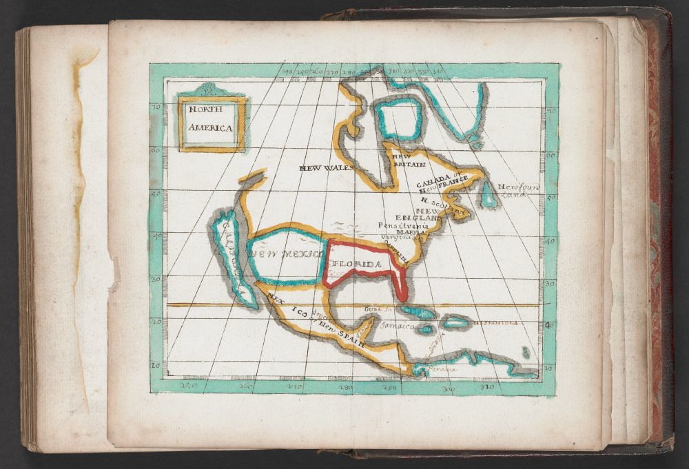
The image shows a vintage map of North America, likely from a book or atlas. The map is rendered in a somewhat naive or folk-art style, with simplified shapes and bright colors. The map depicts the eastern coast of North America, from what appears to be Canada down to the Caribbean islands. The landmasses are outlined in bold colors – blue for areas like New Wales and New Mexico, red for Florida, and green for New Spain (Central America). The Caribbean islands are also depicted, with names like Jamaica visible. The map is overlaid with a grid of latitude and longitude lines, marked with numerical values. A title block in the upper left corner reads "North America". The map is set within the pages of a book, with the edges of the pages visible around the map. The paper appears aged and slightly discolored, suggesting the map is quite old. The overall impression is of a historical document, possibly a hand-drawn or early printed map.