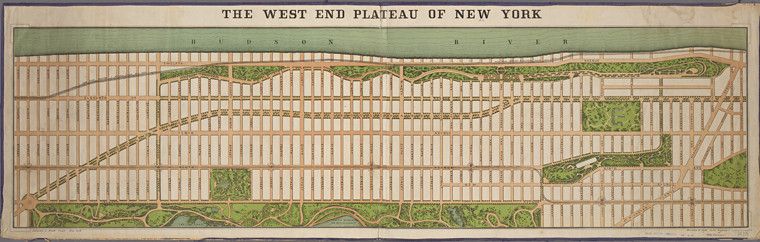
The image is a vintage map titled "The West End Plateau of New York". It depicts a grid-like layout of the city, specifically the West End area. The map is oriented horizontally, with the Hudson River running along the left edge and a lighter-colored river (likely the East River) along the right. The city is laid out in a strict grid pattern of streets and avenues. Blocks are filled with small, rectangular shapes representing buildings. Scattered throughout the grid are larger, irregularly shaped green areas, indicating parks or open spaces. A prominent, large park is visible towards the top right corner, likely Central Park. A winding, dark line cuts across the map, representing a railway or elevated train line. The map is rendered in a muted color palette, with shades of green, brown, and beige dominating. The text at the top is in a decorative, old-fashioned font. The overall aesthetic is reminiscent of a 19th-century city plan or map.