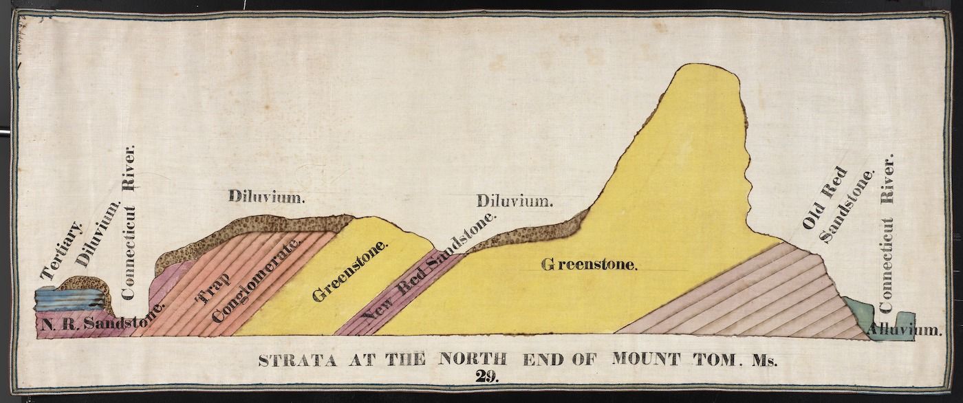
This is a vintage, hand-colored geological diagram depicting the strata at the north end of Mount Tom, Massachusetts. It's a cross-section view, showing the layers of rock and sediment beneath the surface. The diagram features a stylized mountain shape, with layers of different colored rock and sediment forming its structure. The layers are labeled with names like 'Diluvium,' 'Conglomerate,' 'Greystone,' 'New Red Sandstone,' 'Old Red Sandstone,' and 'Alluvium.' The layers are colored in shades of brown, red, yellow, and green to differentiate them. On the left side of the diagram, there's a depiction of a river with a small boat on it, labeled 'Connecticut River.' The river flows alongside the layers of sediment and rock. Below the diagram, there's text that reads 'STRATA AT THE NORTH END OF MOUNT TOM, Ms.' and the number '29'. The overall style of the diagram is reminiscent of 19th-century scientific illustrations, with a focus on clarity and detail.