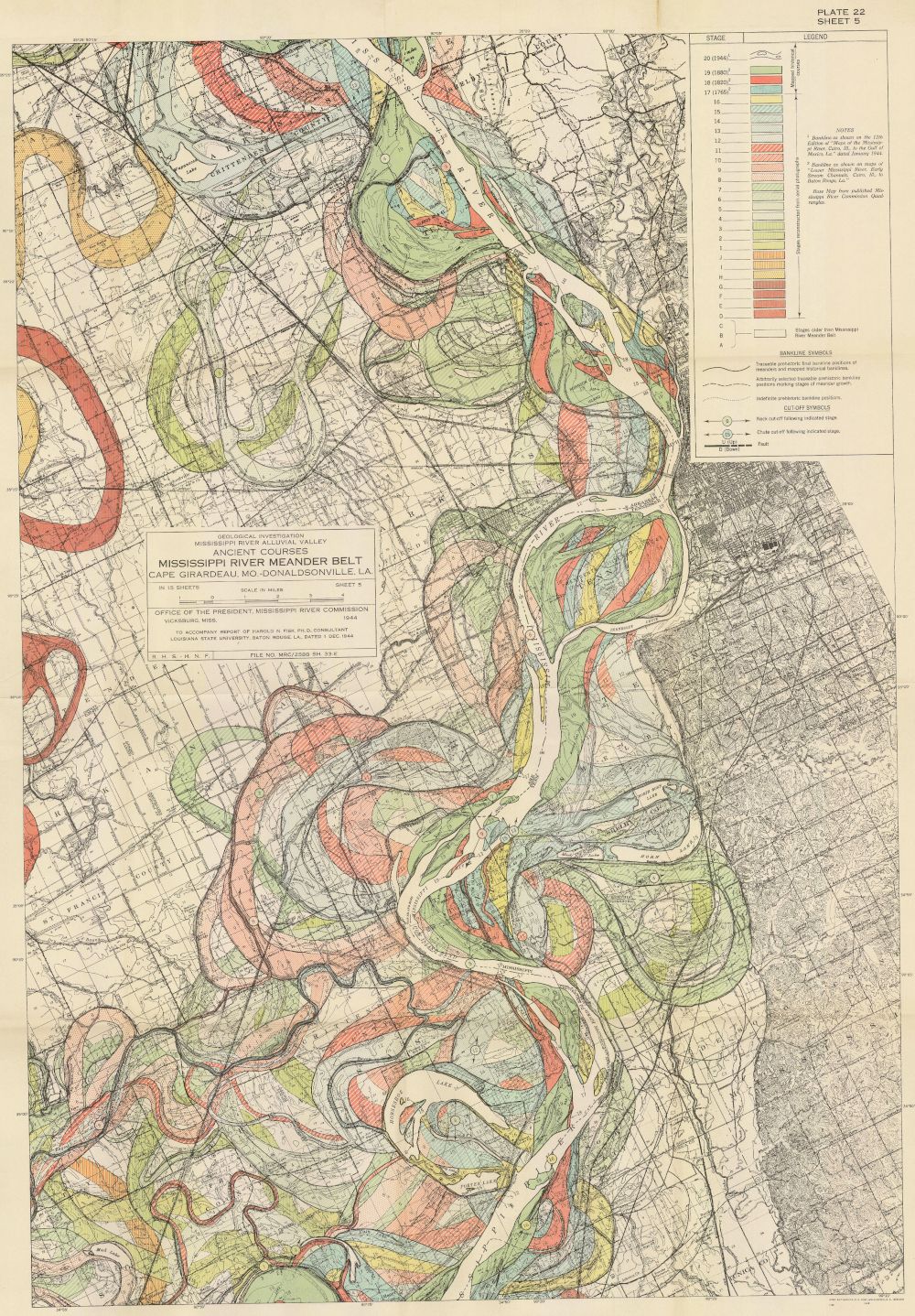
The image is a vintage geological map titled "Mississippi River Meander Belt". It's a detailed topographic map with a color-coded legend indicating different geological formations and land features. The map depicts a winding river (the Mississippi) flowing through a flat, alluvial plain. The river is characterized by numerous meanders, oxbow lakes, and abandoned channels. The land surrounding the river is colored in various shades of green, yellow, orange, red, and purple, representing different soil types, sediment deposits, and geological formations. There are numerous lines and symbols on the map indicating contour lines, roads, towns, and other geographical features. A detailed legend in the upper right corner explains the meaning of the different colors and symbols used on the map. The map also includes text labels identifying towns, rivers, and other geographical features. The overall impression is of a highly detailed and informative geological map of the Mississippi River meander belt.