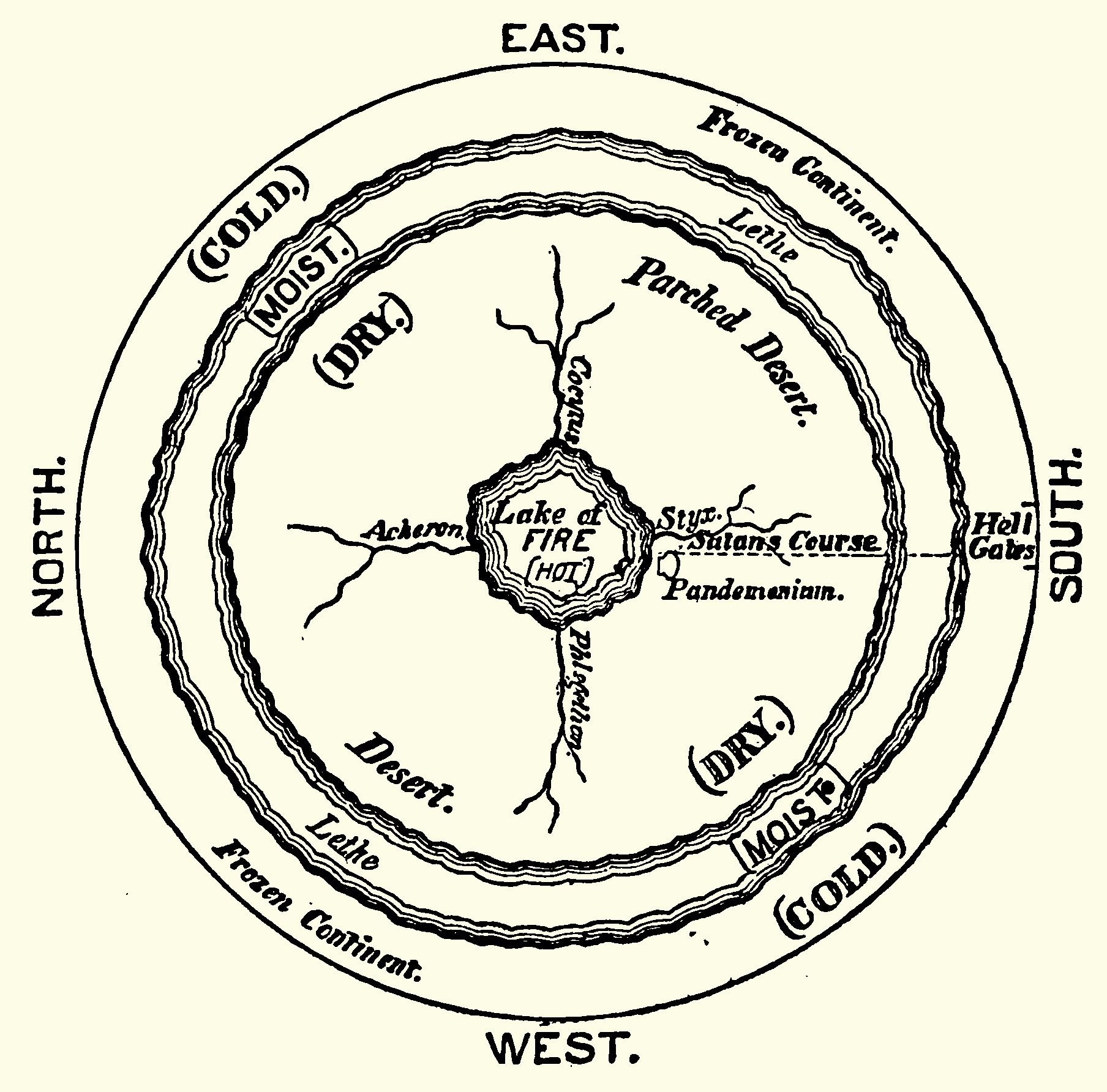
This is a vintage-style, black and white illustration of a circular map. It depicts a world with concentric rings representing different climate zones and geographical features. **Central Area:** At the very center is a small, irregularly shaped area labeled "Lake of FIRE [HOT]" in capital letters. Branching out from this central lake are winding lines resembling rivers or channels. **Inner Ring:** Surrounding the central lake is a region labeled "Desert." **Middle Ring:** This ring is divided into sections. On the right side, it's labeled "Parched Desert." On the left side, it's labeled "Desert." **Outer Ring:** This is the outermost ring, and it's divided into sections labeled "Frozen Continent" on both the east and west sides. **Climate Zones:** Along the edges of the rings, there are labels indicating climate zones: "(COLD), (MOIST), (DRY)" are repeated around the circumference. **Additional Labels:** There are several other labels scattered around the map, including: * "Acheron" * "Styx" * "Sultan's Course" * "Pandemonium" * "Hell Gates" * “Cocitus” * “Phlegethon” * “Lethe” **Cardinal Directions:** The four cardinal directions (North, South, East, West) are clearly marked around the perimeter of the circle. The style of the illustration is reminiscent of old maps or diagrams, with detailed linework and a slightly rough texture. It appears to be a symbolic or allegorical representation of a world, possibly related to mythology or religious concepts.