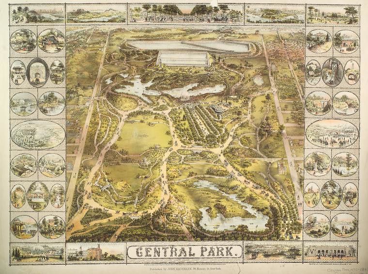
This is a vintage, illustrated map of Central Park in New York City. The map is rendered in a warm, sepia-toned palette with detailed illustrations. The central focus is a bird's-eye view of Central Park itself. The park is depicted as a lush, green space with a large, elongated lake winding through it. Numerous trees are illustrated, creating a dense forest-like appearance. Paths and roads meander throughout the park, and small figures of people and carriages are scattered throughout, suggesting activity and leisure. Surrounding the central map are a series of oval vignettes, each framed with a decorative border. These vignettes depict various scenes within the park, such as people boating on the lake, enjoying picnics, riding horses, and engaging in other recreational activities. They offer a glimpse into the park's diverse offerings and the ways in which people used the space. At the bottom of the map, there's a row of smaller illustrations depicting buildings and cityscapes surrounding the park, providing context to its location within New York City. Text is present at the bottom of the map, indicating the title “Central Park” and the publisher’s information. The overall style of the map is reminiscent of 19th-century cartography and illustration, with a focus on detail and artistic representation.