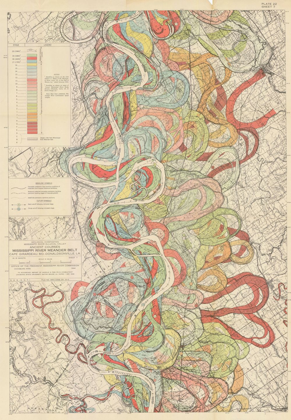
The image is a vintage, detailed map titled "MISSISSIPPI RIVER MEANDER BELT, CAPE GIRARDEAU, MO. TO DONALDSONVILLE, LA.". It's a geological map showing the ancient courses of the Mississippi River. The map is dominated by a complex network of winding, colored lines representing different stages of the river's meanders over time. These lines are overlaid on a base map with a muted green and yellow color scheme, suggesting land elevation and terrain. The lines are color-coded, with a legend on the upper left corner explaining the different stages (e.g., 1-oldest, 16-newest). The colors range from reddish-brown to blue, indicating the age of the river channel. The map is densely packed with information, including contour lines, place names, and other geographical features. There's a lot of text labeling different areas and features. The map also includes a scale and a north arrow. The overall impression is of a highly detailed and scientific document, likely used for geological research or planning.