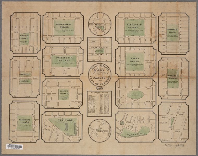
This is a vintage map titled "Public Squares, Parks & Places of the City of New York". It's a detailed, illustrated map from 1852, showcasing various public spaces within the city. The map is organized as a grid of individual squares, each depicting a different park or square. **Layout & Content:** * **Central Circle:** A circular area in the center contains the title and a list of abbreviations used in the map. * **Individual Squares:** Surrounding the central circle are ten individual squares, each representing a specific park or square. These include: Bloomingdale Square, Washington Square, Bryant Park, Hudson Square, Tompkins Square, The Park (Central Park), Battery, Union Place, Madison Square, and Observatory Place. * **Detailed Illustrations:** Each square contains a detailed illustration of the park or square, including trees, pathways, buildings, and surrounding streets. The illustrations are rendered in a delicate, hand-drawn style. * **Grid System:** A grid system is used within each square to indicate street layouts and block sizes. * **Text Labels:** Each square is labeled with the name of the park or square, as well as street names and other relevant information. **Color & Style:** The map is primarily rendered in shades of green, brown, and black. The illustrations are delicate and detailed, with a vintage aesthetic. The overall style is reminiscent of 19th-century cartography. **Overall Impression:** The map is a fascinating historical document that provides a glimpse into the public spaces of New York City in the mid-19th century. It's a beautifully illustrated and informative piece of cartography.