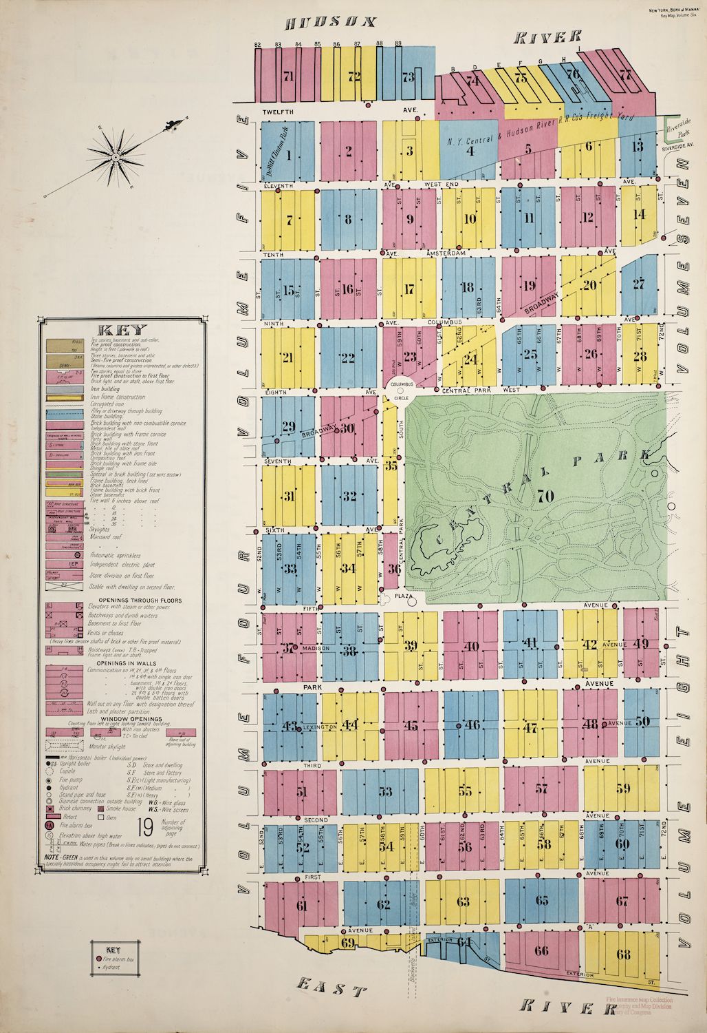
The image is a vintage, detailed map of Manhattan, New York City, likely from the late 19th or early 20th century. It's a grid-based map, with blocks representing city blocks, and streets and avenues forming the grid. The map is color-coded, with different colors representing different building materials or construction types. A detailed key or legend on the left side explains the color coding, listing various building materials like brick, stone, wood, and iron, along with their corresponding colors. The map is numbered, with each block assigned a number. The map covers a significant portion of Manhattan, extending from the East River to the Hudson River and from approximately 12th Street to Battery Park. Central Park is prominently featured as a large green area in the center of the map. The East River and Hudson River are labeled along the edges of the map. Streets and avenues are labeled with their names. The map is aged, with a slightly yellowed and worn appearance. The overall impression is of a meticulously detailed and historically significant document.