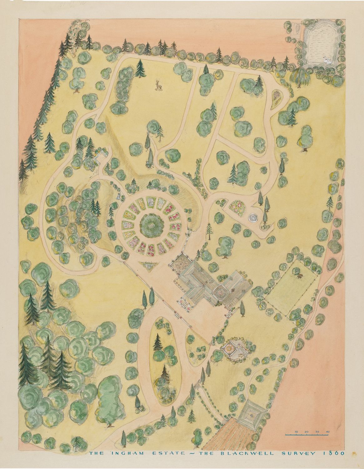
This is a vintage map or survey of the Ingham Estate, dated 1860. It's rendered in a bird's-eye view, showing the layout of the estate grounds. The color palette is dominated by soft yellows and greens, giving it a faded, antique appearance. The estate is characterized by a large, central building, likely a manor house, surrounded by a complex arrangement of gardens and landscaping. A prominent feature is a circular garden with a colorful, patterned design at its center. Radiating from this central garden are pathways and smaller garden plots. The grounds are heavily wooded, with numerous trees depicted as rounded, green masses. These trees are scattered throughout the estate, creating a park-like setting. There are also indications of pathways and driveways connecting the buildings and gardens. The map is labeled at the bottom with the estate name and the surveyor's information. A scale is also provided, indicating the dimensions of the estate. The overall impression is one of a well-maintained and meticulously planned estate, typical of the Victorian era.