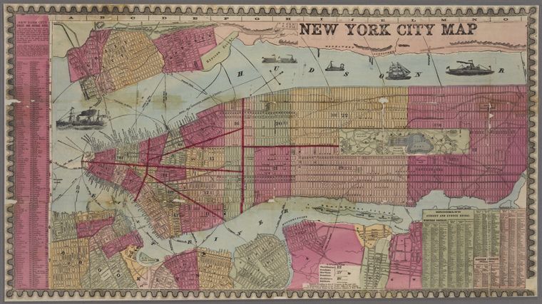
This is a vintage map of New York City, likely from the 19th century. The map is rendered in a colorful, somewhat faded style, with a grid-like pattern dividing the city into numerous blocks. The color palette is dominated by shades of pink, yellow, and green. The map depicts the island of Manhattan as the central focus, with waterways surrounding it. There are depictions of ships on the water, adding to the historical feel. The grid system is quite detailed, showing the layout of streets and blocks. Along the edges of the map, there are various text labels and annotations, including a grid of letters and numbers along the top and side, likely for referencing specific locations. There's also a key or legend in the lower right corner with detailed text. The map is framed by a decorative border with a repeating wave-like pattern, adding to its antique aesthetic. The overall impression is that of a historical document, showcasing the urban layout of New York City from a bygone era.