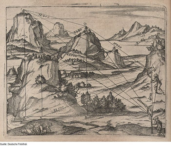
This is a detailed, antique-style engraving depicting a mountainous landscape overlaid with a complex geometric diagram. The scene is dominated by several jagged mountains in the background, with a valley and a cluster of trees in the midground. A small village or town is nestled within the valley, with buildings and what appear to be people scattered throughout. Overlaid on this landscape is a network of straight lines connecting various points on the mountains, trees, and buildings. These lines are accompanied by numerical annotations, such as '12.400', '15.000', '20.500', and '22.400', suggesting measurements or calculations. On the right side of the image, there's a tall, ladder-like structure with a figure climbing it. This structure also has lines extending from it, connecting to points in the landscape, further emphasizing the diagrammatic nature of the image. The style of the engraving is reminiscent of early scientific illustrations or maps, with a focus on precise lines and detailed rendering of the landscape. The overall impression is one of a meticulous attempt to map or measure the terrain using geometric principles.