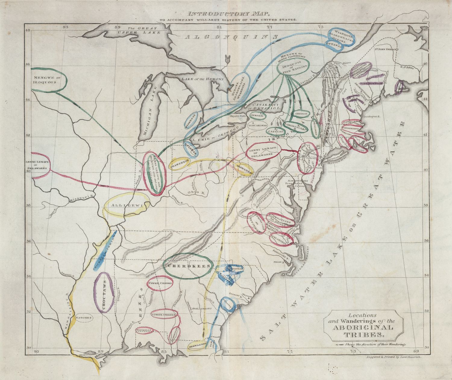
This is a vintage map titled "Introductory Map, to Accompany Willard's History of the United States." It depicts the eastern portion of North America, focusing on the areas inhabited by various Native American tribes. The map is sepia-toned and appears to be hand-drawn or lithographed. It features a network of rivers and lakes, including the Great Lakes (Lake Superior, Lake Michigan, Lake Huron, Lake Erie, and Lake Ontario) and the St. Lawrence River. The coastline is detailed, showing bays and inlets. Overlaid on the geographical features are numerous irregularly shaped areas outlined in different colors (red, blue, green, yellow, pink). These areas represent the territories of various Native American tribes, with the names of the tribes written within or near the boundaries. Some of the tribes labeled include the "Cherokee", "Choctaw", "Creek", "Chickasaw", "Shawnee", "Delaware", "Iroquois", "Mohegan", "Nanticoke", and many others. Lines are drawn across the map, indicating the "Locations and Wanderings of the Aboriginal Tribes." These lines are colored and seem to trace the historical movements and migrations of the tribes. The map includes a coordinate grid along the top and side, indicating latitude and longitude. There's a legend in the lower right corner that explains the meaning of the colored lines and tribal territories. The overall impression is of a historical document that attempts to map the geographical distribution and movements of Native American tribes in the eastern United States.