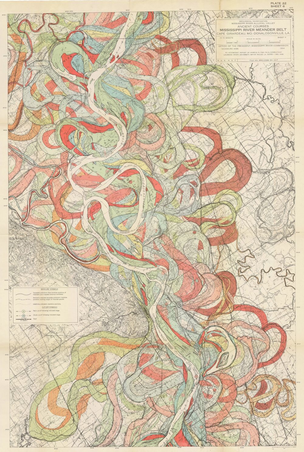
This is a vintage map titled "Mississippi River Meander Belt, Louisiana and Mississippi". It depicts the historical course of the Mississippi River, showing its meanders and oxbow lakes over time. The map is dominated by a complex network of winding lines in various colors – red, yellow, green, and blue – representing different stages of the river's path. The terrain is shown with subtle shading and contour lines, indicating elevation changes. There are also indications of settlements and infrastructure, though they are less prominent than the river features. The map includes a title block with detailed information about the source and date of the map, as well as a legend explaining the color coding and symbols used. A scale is also provided to indicate distances on the map. The overall impression is one of a detailed and informative historical document, showcasing the dynamic nature of the Mississippi River and its impact on the surrounding landscape.