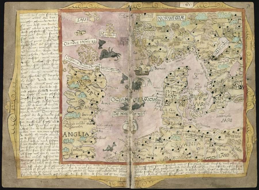
This is a detailed, antique map, likely from a medieval or early Renaissance manuscript. It's a double-page spread, with a faded, aged appearance. The map depicts a portion of Europe, including areas like Anglia (England), Germania, and Scandinavia. The map is rendered in a style that blends geographical features with illustrative elements. The map is filled with hand-drawn illustrations of cities, towns, and landmarks. These are represented by small, stylized buildings and symbols. The coastlines are irregular and detailed, and the landmasses are colored in shades of pink, green, and brown. The sea is depicted with wavy lines and is populated with illustrations of sea monsters and ships. Along the margins of the map, there is a dense amount of handwritten text in Latin. This text likely provides additional information about the places depicted on the map, as well as historical or geographical notes. The map is framed by a decorative border, which adds to its antique and artistic appeal. The overall impression is one of a meticulously crafted and historically significant document, offering a glimpse into the geographical knowledge and artistic sensibilities of a bygone era.