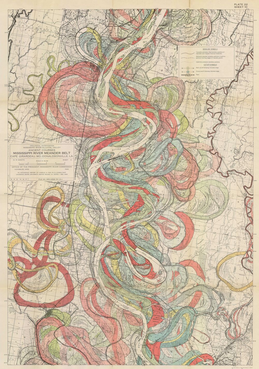
The image is a vintage, detailed map titled "Mississippi River Meander Belt, Cape Girardeau, Mo. to Donaldsonville, La.". It's a topographic map focusing on the winding course of the Mississippi River. The river itself is a prominent feature, depicted as a sinuous, light-colored line snaking through a broad floodplain. The floodplain is filled with a dense pattern of curved, colored lines representing the meanders and former river channels. These lines are in shades of red, green, yellow, and blue, creating a complex, almost abstract pattern. The map is aged, with a yellowish tint and visible creases, suggesting it's an older document. There's a legend in the upper right corner explaining the symbols and colors used on the map. Text labels identify towns, cities, and geographic features. A scale is present, indicating the distance represented on the map. The map is labeled "Plate 22, Sheet 10" in the upper right corner. The overall impression is of a detailed scientific illustration of a river system, showcasing its dynamic and ever-changing nature.