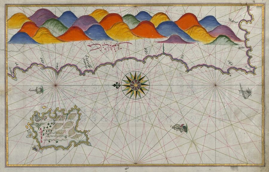
This is a detailed, antique map with a distinctive style. The map depicts a coastline with a mountainous backdrop. The coastline is intricately drawn with bays, inlets, and a rugged, textured appearance. The mountains are stylized, depicted as a series of rounded, colorful hills in shades of blue, purple, green, orange, and brown. The sea area is covered with a network of red lines radiating from a central point, creating a star-like pattern. A prominent compass rose is located near the center of the map, featuring ornate designs and directional markings. Several ships are scattered across the sea, adding a sense of scale and activity. Arabic script is visible along the coastline, labeling various locations and features. The overall aesthetic is reminiscent of Ottoman or Islamic cartography, with a focus on artistic representation and symbolic imagery rather than strict geographical accuracy. The map is rendered in a muted color palette, with earthy tones and subtle shading.