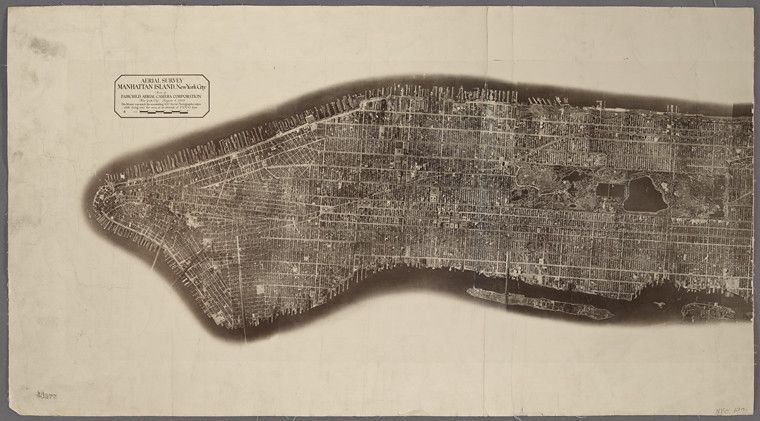
This is a vintage aerial photograph of Manhattan Island, New York City. The image is a detailed map-like view of the island, showing a dense network of streets and buildings. The island is elongated and narrow, with water surrounding it on all sides. The buildings appear as small, dark rectangles, creating a textured pattern across the island. The streets are visible as lighter lines crisscrossing the landscape. A small patch of green, likely Central Park, is visible in the center of the island. The image is sepia-toned and appears to be a historical document. A small text block in the upper left corner reads 'AERIAL SURVEY MANHATTAN ISLAND New York City' and includes some additional smaller text. The image is divided into three sections by vertical lines, suggesting it was originally a larger print that was divided for storage or display. The bottom left corner has a number '4377' written on it.