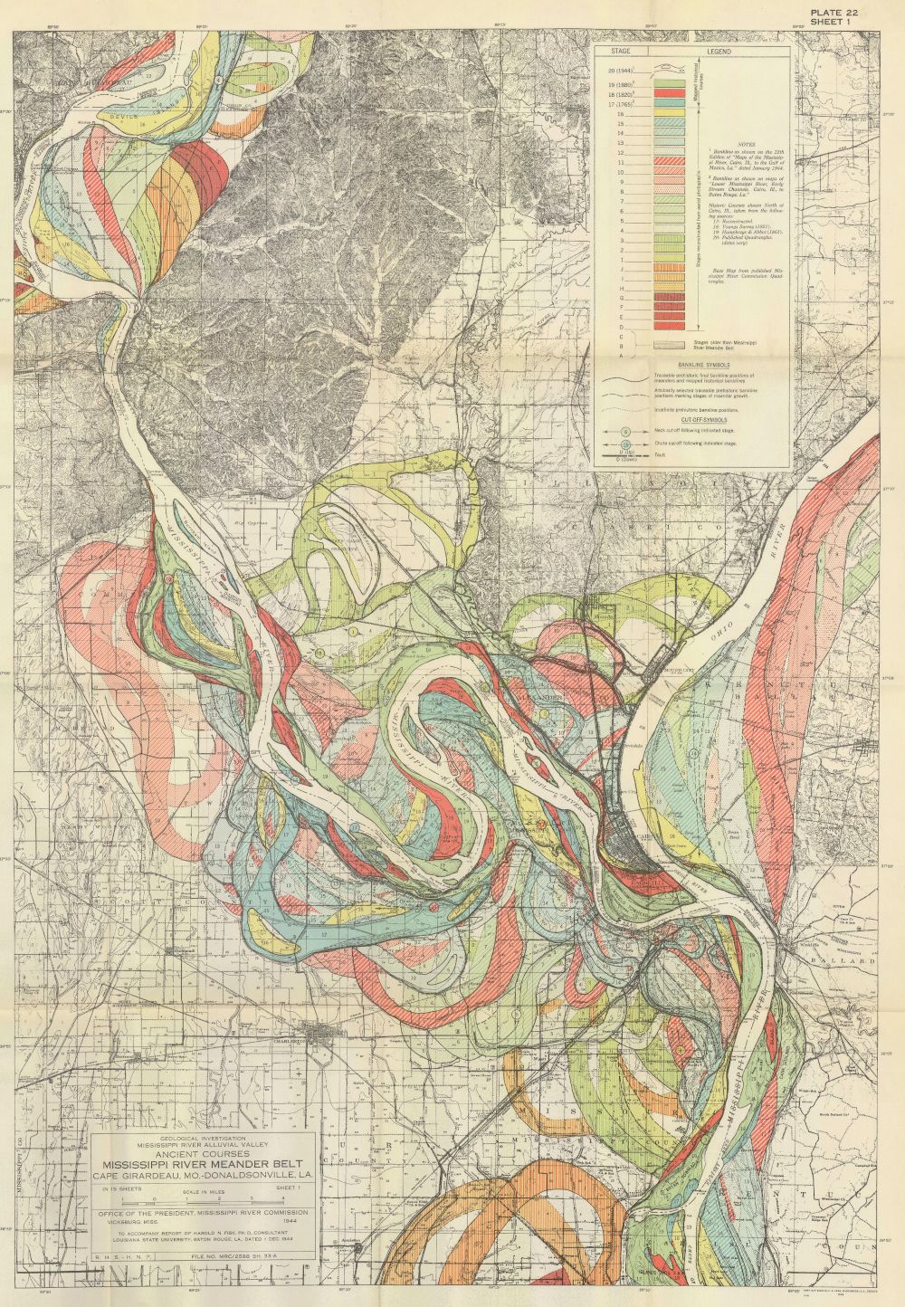
The image is a detailed, vintage map depicting the ancient courses of the Mississippi River in the Meander Belt, specifically around Cape Girardeau, Missouri and the surrounding areas. It's a topographic map with a grid overlay, and a complex color scheme used to illustrate different stages and features of the river's past channels. The map is dominated by the winding, serpentine form of the present-day Mississippi River, shown as a bright white line. Surrounding this are numerous curved lines and colored areas representing the former courses of the river, indicating how it has shifted and changed over time. These older channels are color-coded, with shades of yellow, green, blue, red, and orange, each representing a different stage or age of the channel. The map includes a detailed legend in the upper right corner, explaining the color coding and symbols used. It also features a scale for measuring distances. There's text at the bottom of the map indicating the title, source, and date of the map. The map is filled with intricate details, including contour lines, place names, and other geographic features. The overall impression is one of a complex and meticulously researched document, illustrating the dynamic history of the Mississippi River.