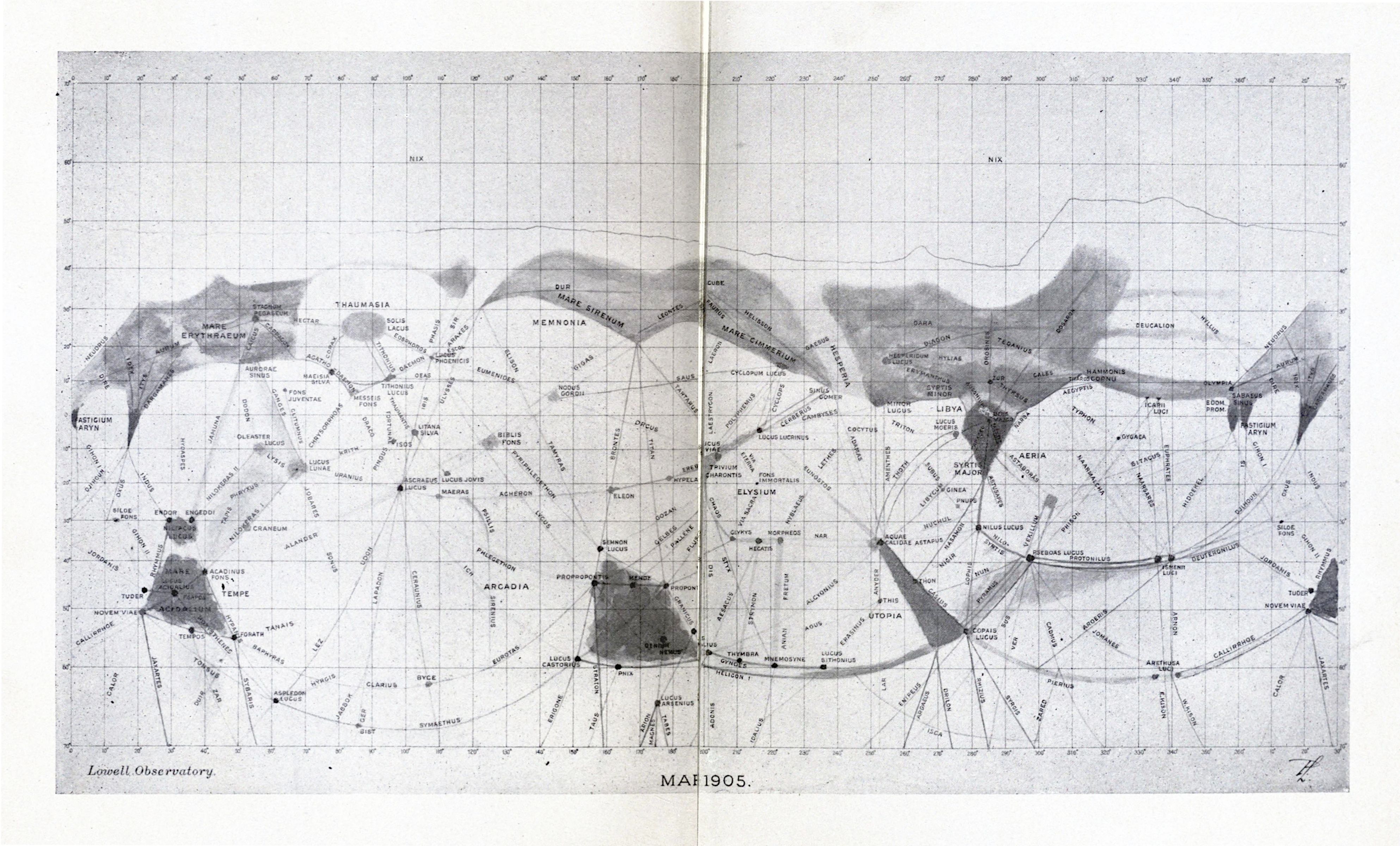
The image is a vintage map of Mars, dated May 1905, produced by the Lowell Observatory. It's a black and white projection of the Martian surface, covered in a fine grid of latitude and longitude lines. **Key Features:** * **Dark and Light Areas:** Large portions of the map are shaded in varying tones of gray, representing different surface features. Darker areas seem to indicate plains or valleys, while lighter areas likely represent highlands or elevated terrain. * **Canals:** A network of thin, straight lines crisscrosses the surface, representing the famous “canals” observed by Percival Lowell and his team. These lines are connected by numerous small dots and symbols, indicating their intersections and features. * **Named Regions:** Various regions of Mars are labeled with names like “Arcadia,” “Elysium,” “Memnonia,” “Libya,” and “Scythia.” These names are written in a small, elegant script. * **Symbols and Dots:** Numerous small dots and symbols are scattered across the map, likely representing specific features, observations, or points of interest. * **Grid System:** A fine grid of latitude and longitude lines covers the entire map, providing a coordinate system for locating features. * **Text:** The map includes text at the bottom indicating the observatory and date, “Lowell Observatory. May 1905.” **Overall Impression:** The map has a historical and scientific feel, reflecting the early 20th-century attempts to map and understand the surface of Mars. The intricate network of canals and the detailed labeling of regions give the map a unique and fascinating appearance. The image is somewhat faded and grainy, adding to its vintage charm.