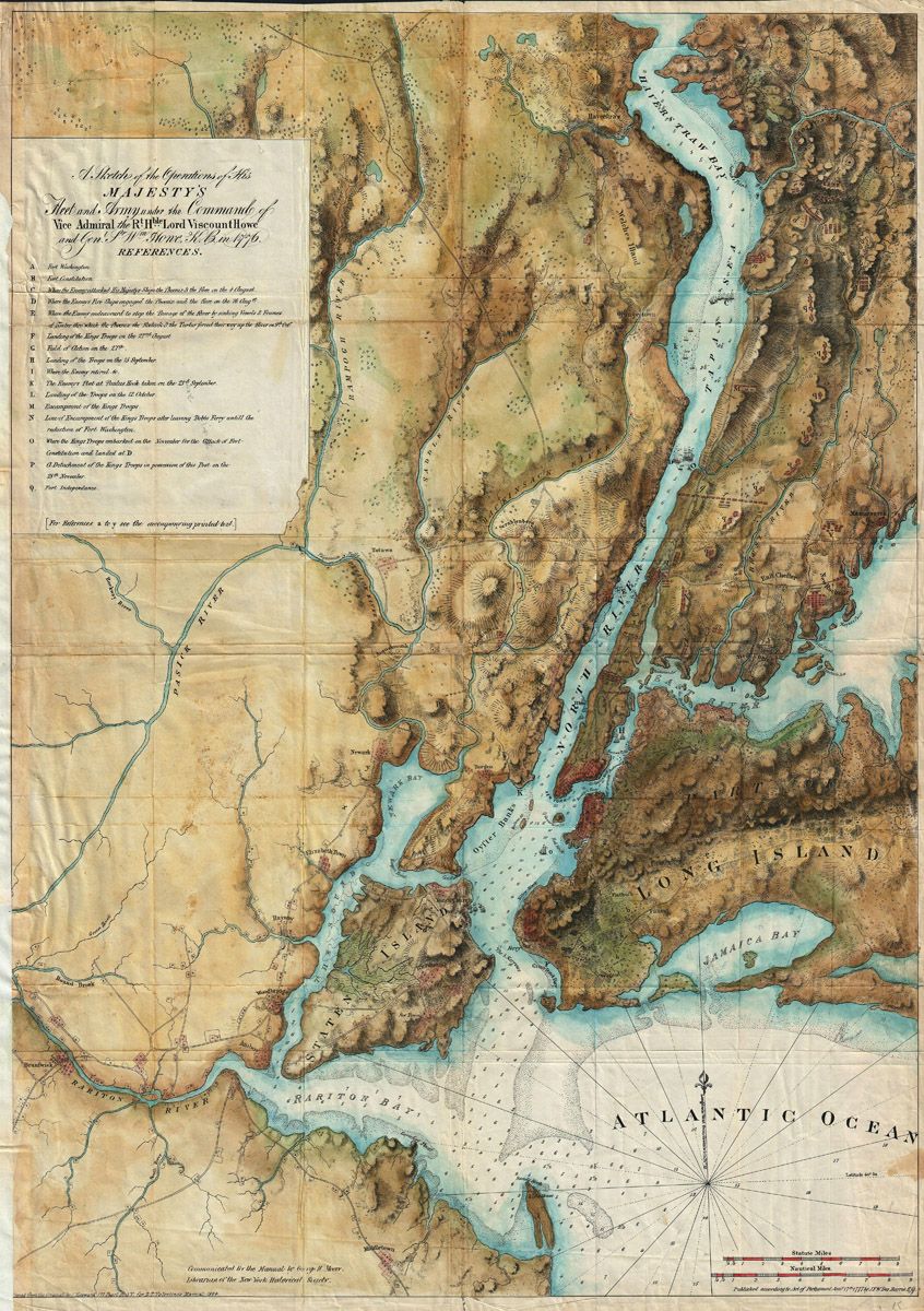
This is a detailed, antique map depicting a coastal region with a complex network of waterways. The map is rendered in a faded, sepia tone, characteristic of historical cartography. The central feature is a long, winding river, colored in shades of blue, that dominates the landscape. It flows from the top of the map, branching into numerous smaller tributaries and inlets. The river is surrounded by a rugged coastline, with numerous bays, coves, and islands. To the right of the river is a large island, labeled 'Long Island,' with a distinctive shape. Below Long Island is the 'Atlantic Ocean,' depicted with wave-like patterns. The coastline is dotted with towns, forts, and other settlements, indicated by small drawings. Roads and paths crisscross the landscape, connecting the various settlements. The map also includes a detailed legend, explaining the various symbols and markings used. A compass rose is present, indicating the cardinal directions. A scale is provided, allowing for the measurement of distances. The map is titled 'A Sketch of the Operations of His Majesty's Fleet and Troops in the Command of Vice Admiral Lord Viscount Newport, &c. &c. &c.' and includes a list of references. The overall impression is one of a meticulously crafted and informative historical document.