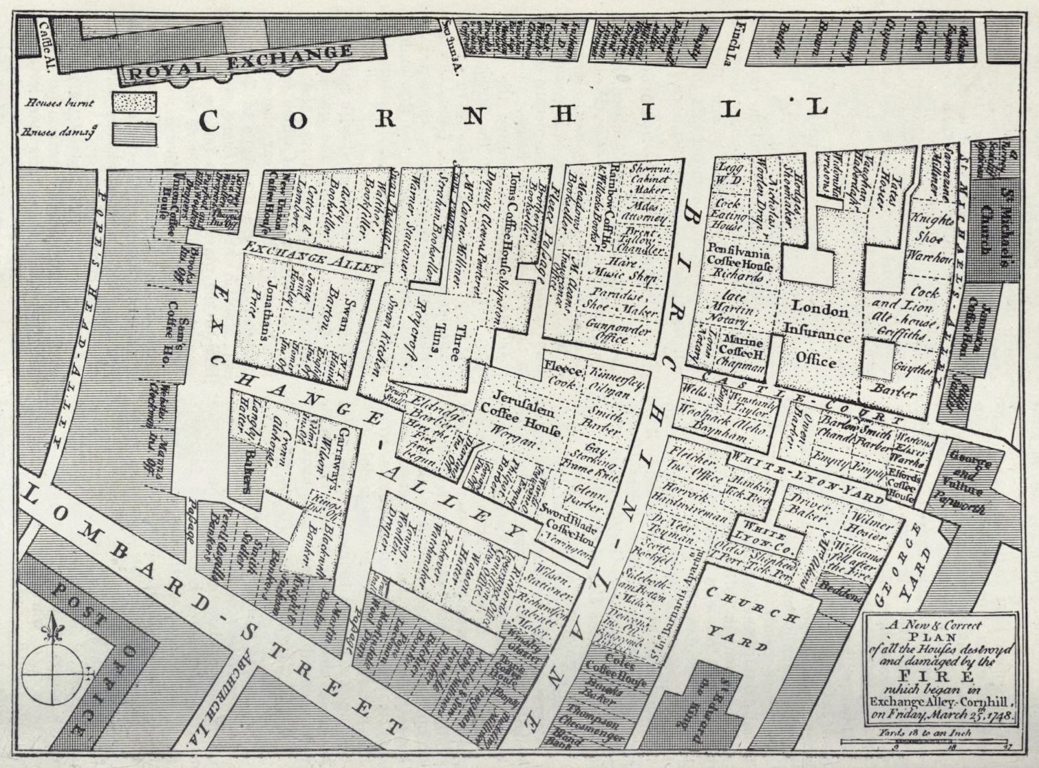
This is a detailed, antique-style map depicting the area around the Royal Exchange in London. It's a bird's-eye view, showing the layout of streets and buildings. The map is rendered in black and white with a fine, intricate linework style typical of historical maps. **Key Features:** * **Streets:** The map shows a network of streets, including Lombard Street, Exchange Alley, Cornhill, and Birchin Lane. The street names are clearly labeled in a small, elegant font. * **Buildings:** Numerous buildings are depicted, each represented as a rectangular block. Many of these blocks are labeled with the names of businesses or occupants, such as coffee houses, merchants, and offices. The buildings are densely packed, indicating a bustling urban environment. * **Royal Exchange:** The map is centered around the Royal Exchange, which is prominently labeled at the top. The Exchange itself is depicted as a large, complex structure. * **Damage Indication:** There are shaded areas within some of the buildings, indicated by a legend that signifies 'Houses burnt' and 'Houses damaged'. This suggests the map documents the aftermath of a fire. * **Compass Rose:** A decorative compass rose is located in the lower-left corner, indicating the map's orientation. * **Text and Notes:** There's a significant amount of text on the map, including street names, building labels, and a note at the bottom that details the fire that took place on Friday, March 27, 1728. **Overall Impression:** The map is a historical document that provides a detailed snapshot of London's urban landscape in the early 18th century. The level of detail is remarkable, and the map offers valuable insights into the city's commercial and social life at the time. The indication of fire damage adds a layer of historical significance, suggesting the map was created to document a specific event.