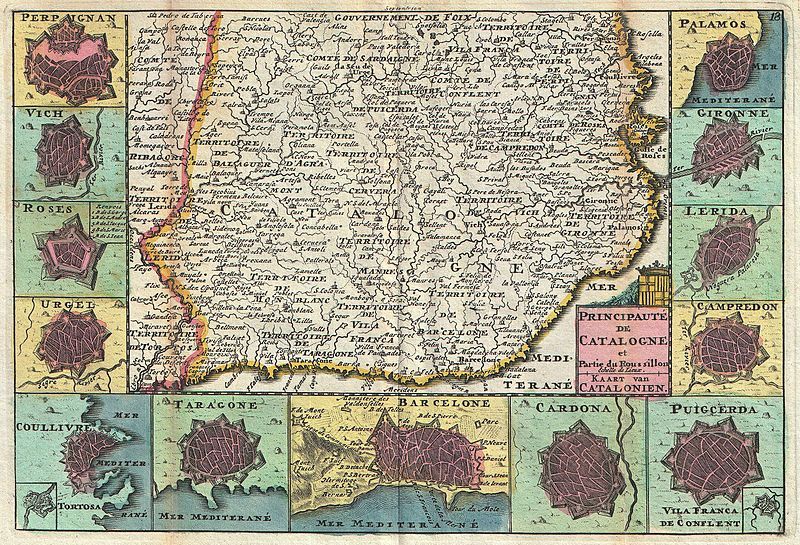
This is a historical map of Catalonia, likely from the 17th or 18th century. It's rendered in a faded, aged color palette of pale greens, pinks, and browns. The map depicts the region of Catalonia, with its coastline along the Mediterranean Sea. Cities and towns are marked with stylized, miniature cityscapes, each a unique illustration of buildings and fortifications. The map is densely labeled with the names of towns, regions, and territories in a small, ornate script. There are also borders delineating different administrative areas. The coastline is detailed, showing bays and inlets. In the corners of the map, there are decorative cartouches containing compass roses and other illustrations. The overall style is characteristic of early modern cartography, with a focus on detail and artistic representation. The map is a valuable historical document, providing insight into the geography and political landscape of Catalonia during that period.