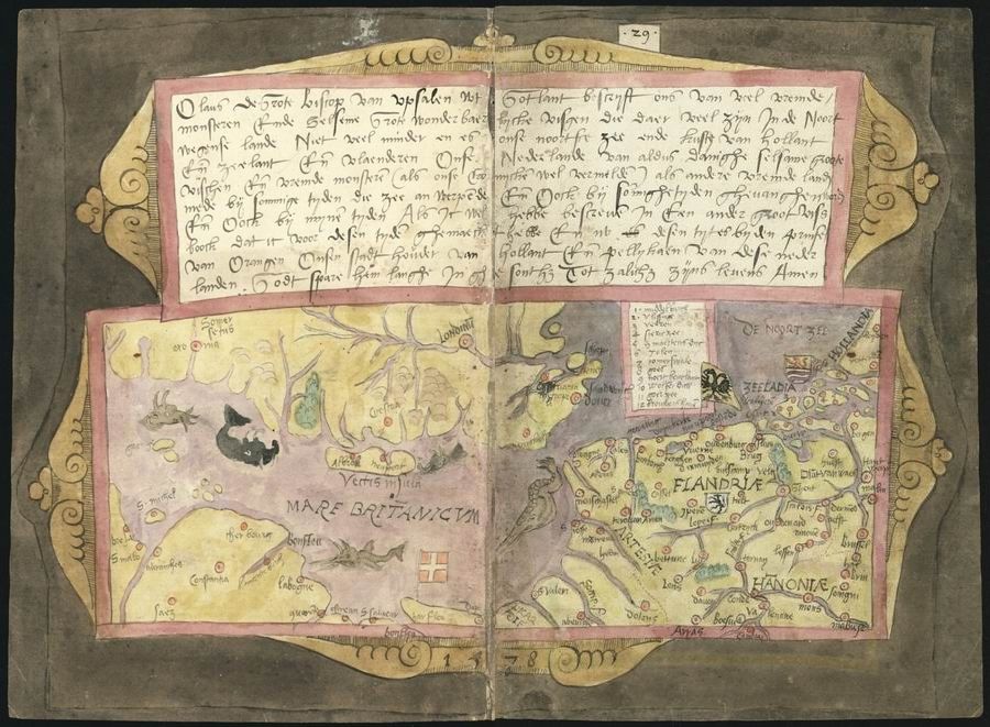
This is a detailed image of an antique map, likely from a medieval or early Renaissance manuscript. The map is presented as a double-page spread, with a decorative border framing the entire composition. The map itself is rendered in a stylized, illustrative manner, with geographical features depicted in a somewhat abstract and symbolic way. The map is divided into two main sections, each representing a different region. The left section is labeled "Mare Britannicum" and depicts the British Isles, with a prominent coastline and various landmasses. The right section shows a region labeled "Flandria" and "Hannonia", representing parts of modern-day Belgium, Netherlands, and Germany. Both sections are filled with intricate details, including rivers, mountains, forests, and settlements. The names of cities, towns, and geographical features are written in a medieval script, adding to the historical charm of the map. Above and below the map sections, there are columns of text written in the same medieval script. This text likely provides additional information about the regions depicted or serves as a commentary on the map. In the upper left corner of the map, there is an illustration of a sea monster, adding a fantastical element to the composition. The monster is depicted with a serpentine body, wings, and a fearsome head. The entire map is rendered in a limited color palette, with shades of pink, brown, and black dominating the composition. The paper appears aged and slightly discolored, adding to the antique feel of the image.