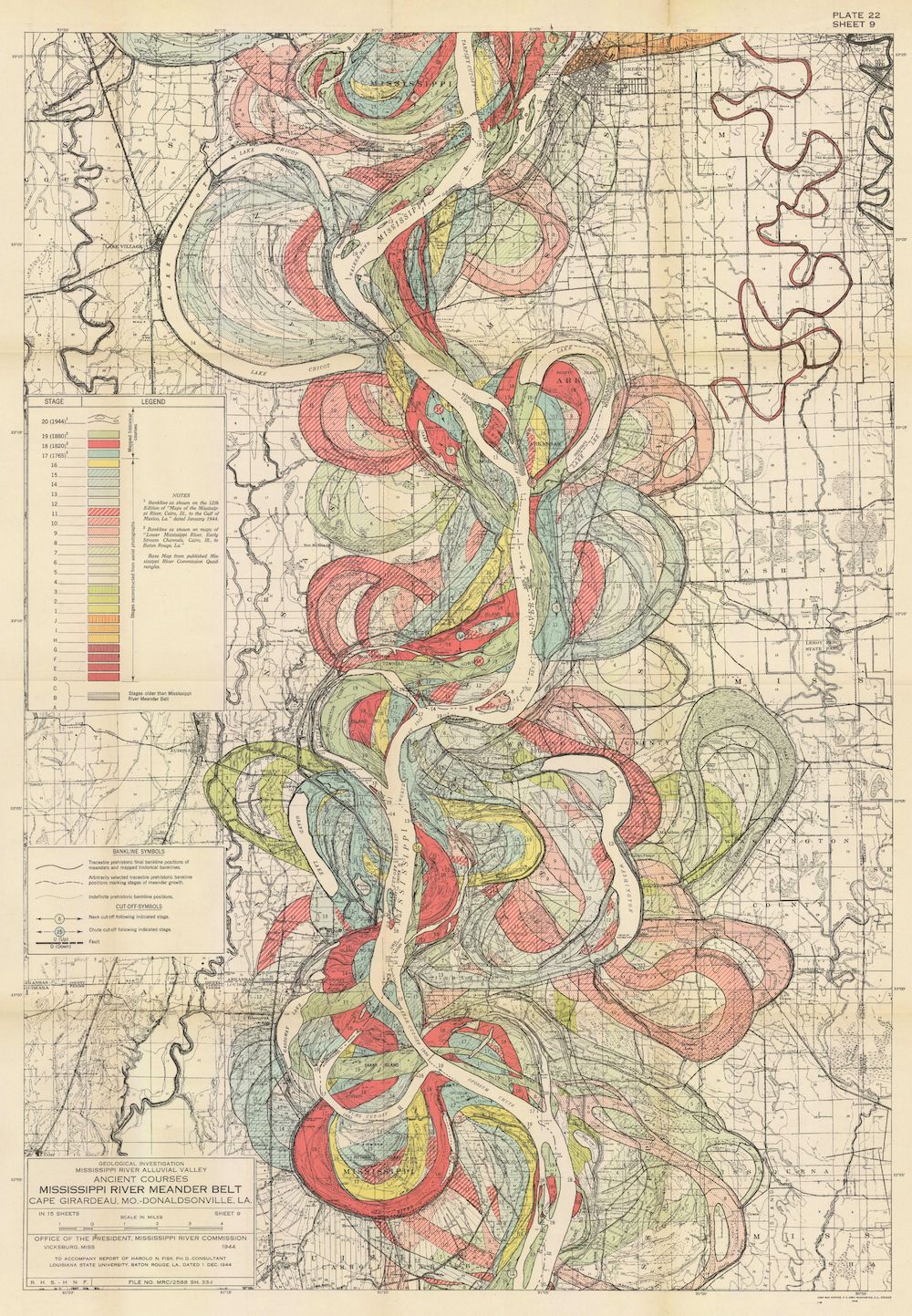
This is a vintage map titled "Ancient Meanders of Mississippi River, Between Cape Girardeau, Missouri and Donaldsonville, Louisiana". It's a detailed topographical map focusing on the historical course of the Mississippi River. The map is dominated by a complex network of colored lines representing the ancient meanders (curves) of the river. These lines are layered on top of each other, showing how the river has shifted its course over time. The colors indicate different stages or ages of the meanders, with a legend on the left side explaining the color coding. The current course of the river is shown as a solid, dark line winding through the center of the map. The map is overlaid with a grid system, likely representing townships and ranges, and various labels indicating towns, counties, and other geographical features. There's a lot of text and information printed on the map, including notes about the source of the data and the methods used to create the map. The overall impression is one of complexity and detail, highlighting the dynamic nature of the Mississippi River and its historical evolution. The map appears to be a scientific document, likely created by the U.S. Army Corps of Engineers or a similar organization. The paper has a yellowish tint, suggesting it is an older document. At the bottom of the map, there is a title block with the map's title, scale, and the name of the organization responsible for creating it. The map is labeled "Plate 22, Sheet 9" in the upper right corner.