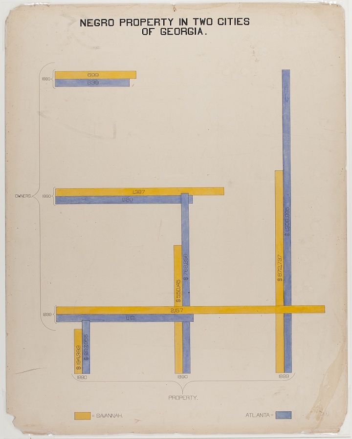
The image is a vintage map or diagram titled "Negro Property in Two Cities of Georgia." It appears to be a visual representation of property ownership in Savannah and Atlanta, Georgia, likely from the early 20th century. The map is rendered in a limited color palette of yellow, blue, and beige. The map is divided into two sections, one labeled "Savannah" and the other "Atlanta." Each section contains a series of rectangular blocks of varying lengths, colored either yellow or blue. These blocks represent properties, with the colors likely indicating ownership (e.g., Negro-owned vs. other). Numbers are written alongside each block, presumably representing the value or size of the property. The numbers are written in a mix of black and blue ink. There are also lines and arrows connecting the blocks, possibly indicating relationships between properties or streets. The map is aged and shows signs of wear and tear, with some discoloration and creases. The overall style is reminiscent of early 20th-century cartography and data visualization.