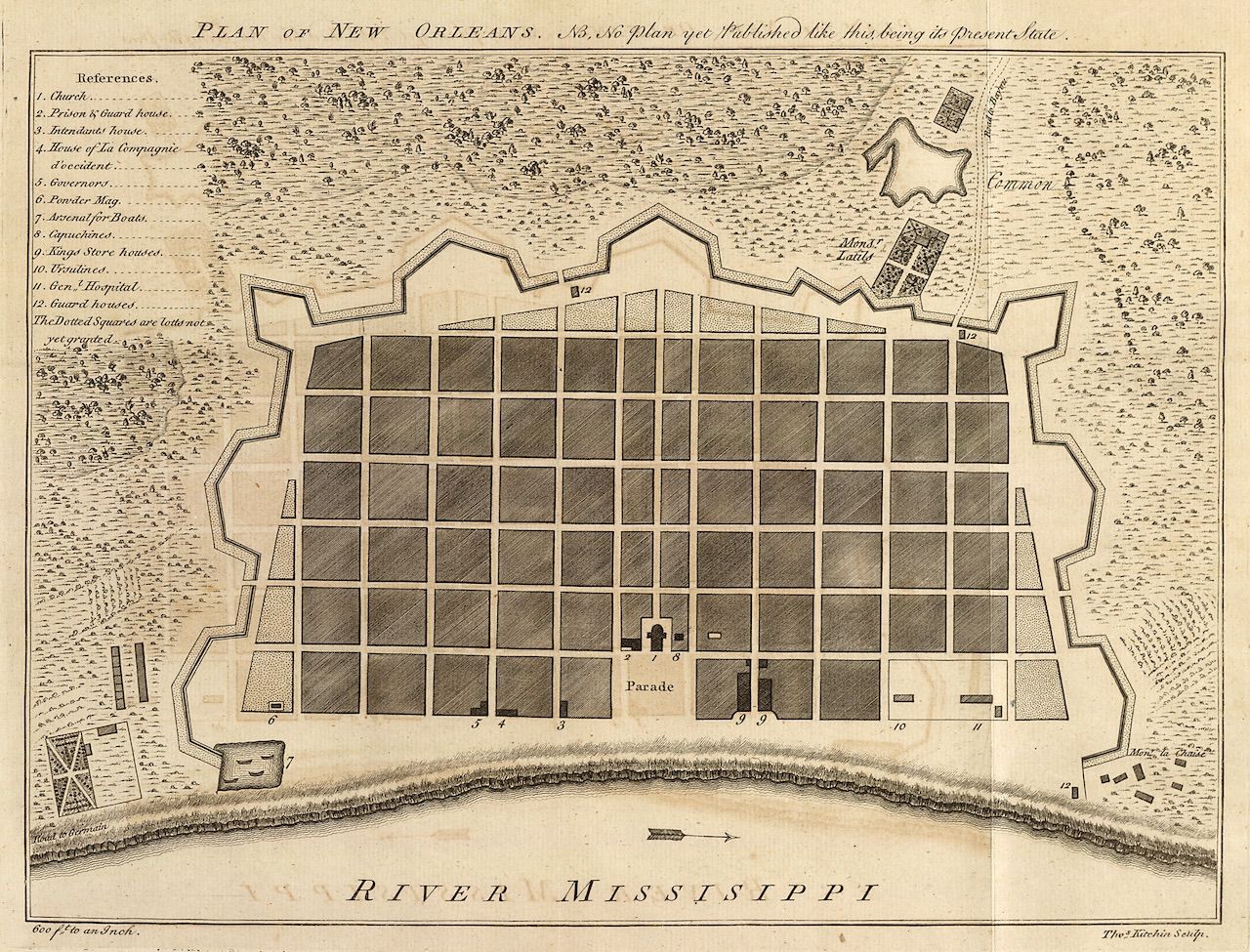
This is a vintage map titled "Plan of New Orleans, as no plan yet Published like this being its present state". It depicts the city of New Orleans in a bird's-eye view, with a grid-like street layout. The city is surrounded by fortifications, including a star-shaped fort and a defensive wall. The Mississippi River flows along the bottom of the map, with the text "RIVER MISSISSIPPI" prominently displayed. The city is divided into rectangular blocks, with small squares representing buildings. Several landmarks are labeled with numbers and a corresponding legend on the left side of the map. These include a church, a prison, a guardhouse, a government building, a powder magazine, and a hospital. A parade is depicted in the center of the city. The map is drawn in a detailed, illustrative style, with shading and texture used to create a sense of depth. A compass rose and a scale are included in the bottom corners of the map. The overall impression is of a historical document that provides a glimpse into the layout and features of New Orleans in the past.