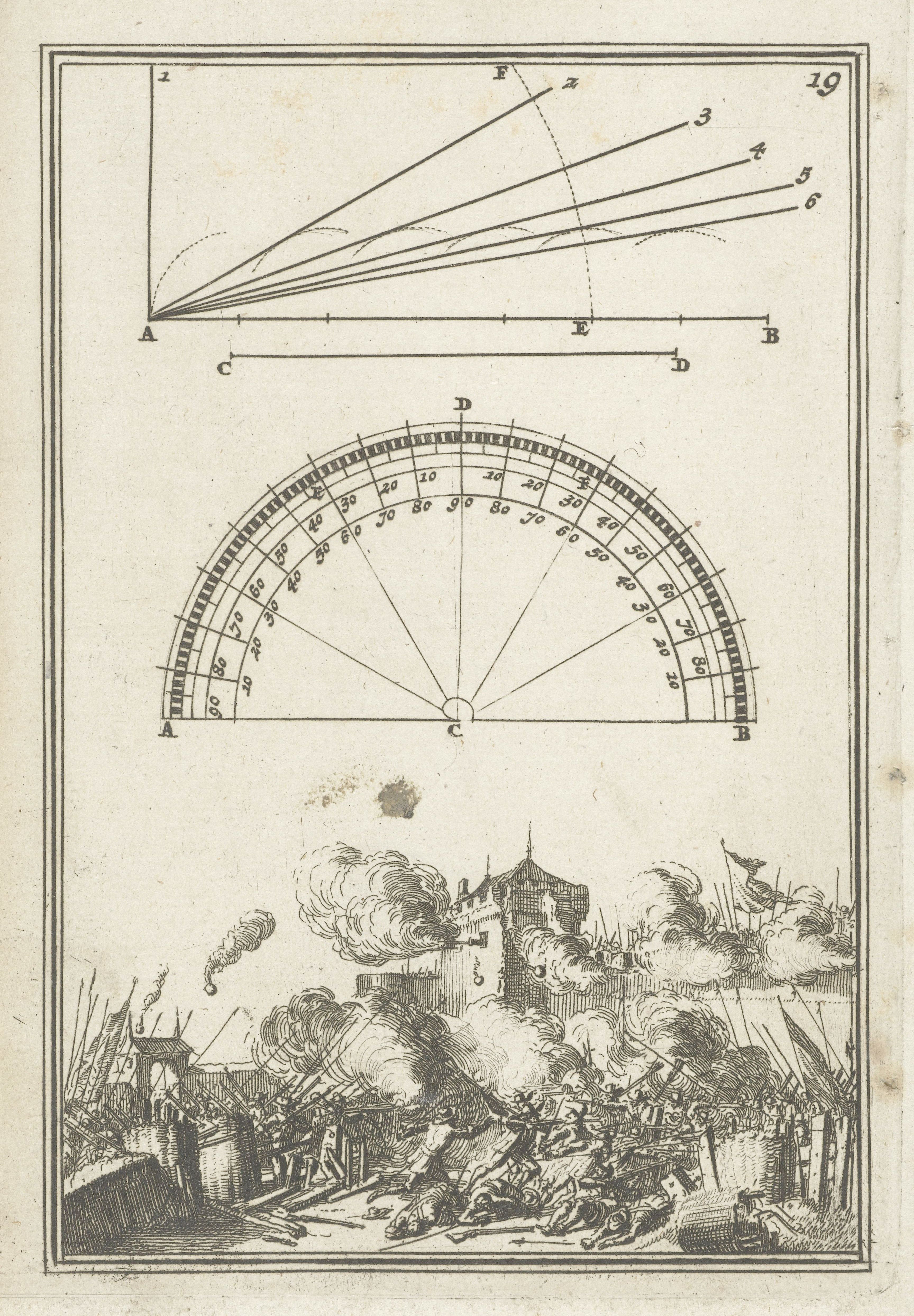
The image is a page from an old book or scientific text, featuring a combination of diagrams and an illustration. It's divided into three distinct sections. **Top Section:** A geometric diagram with lines converging from a point 'F' towards a horizontal line segment 'AB'. There are numbered lines (1-6) radiating from 'F' to 'AB', and points 'C', 'D', and 'E' are marked along the line 'AB'. The diagram appears to illustrate principles of optics or perspective. **Middle Section:** A circular diagram with a scale marked around its perimeter, ranging from 0 to 60 degrees. Lines radiate from the center of the circle, and letters 'A', 'B', and 'C' are marked around the circumference. This section seems to be a protractor or a tool for measuring angles. **Bottom Section:** A detailed illustration of a city under siege. Buildings are burning, with thick smoke billowing into the air. Soldiers are engaged in combat, firing cannons and muskets. The scene is chaotic and depicts a historical battle or conflict. The style is reminiscent of 17th or 18th-century engravings. The overall impression is that this page combines scientific diagrams with a historical illustration, possibly relating to military engineering or ballistics. The page has a yellowish tint, suggesting age and the use of aged paper.