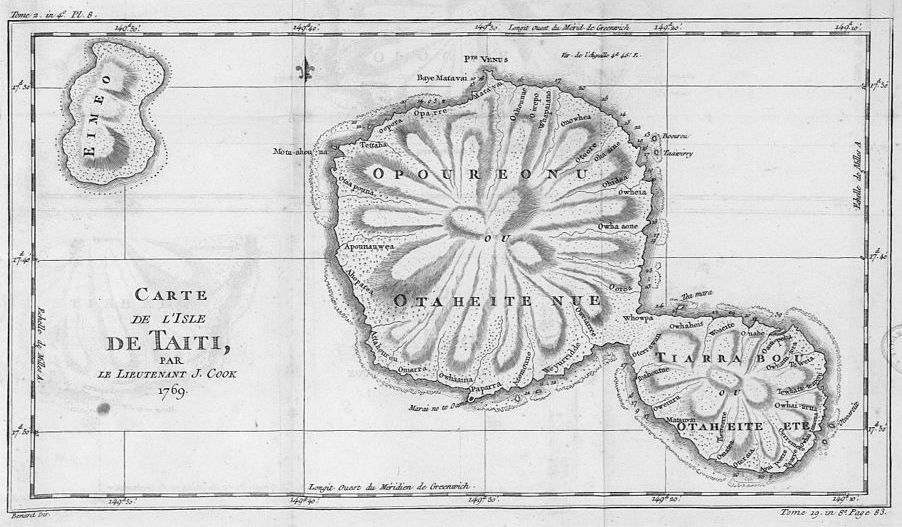
This is a vintage map titled "Carte de l'Isle de Taiti, par le Lieutenant J. Cook, 1769". It depicts the island of Tahiti, with a detailed rendering of its topography. The island is roughly oval-shaped, with a mountainous interior radiating outwards from a central point. The coastline is intricate, with numerous bays and inlets. The map includes names of various locations, such as bays, rivers, and settlements. A compass rose is present, indicating the cardinal directions. A grid system of latitude and longitude lines is overlaid on the map. The map is drawn in a detailed, engraved style, typical of 18th-century cartography. There is a smaller island depicted in the upper left corner and a cluster of smaller islands in the lower right corner. The map is framed by a decorative border.